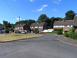
Walters Ash
Appearance

Walters Ash (also sometimes called Walter's Ash) is a village in the
sink hole opened under the drive of a bungalow and a car disappeared down it.[2] The village is 32 miles (51 km) west of London and 3.92 miles (6.31 km) north west of High Wycombe
.
References
- ^ Peace Camps
- ^ "Family: Daughter 'lucky' after car is swallowed by sinkhole - as a second hole is found". Bucks Free Press. Retrieved 27 April 2022.
This article needs additional citations for verification. (September 2014) |
External links
51°40′30″N 0°47′28″W / 51.675°N 0.791°W

