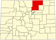
Wattenburg, Colorado
Appearance
Wattenburg, Colorado
Wattenberg, Colorado | ||
|---|---|---|
ZIP code[2] 80621 (Fort Lupton) | ||
| GNIS feature ID | 0180850 | |
Wattenburg or Wattenberg is an
ZIP code 80621) now serves Wattenburg postal addresses.[2]
Geography
Wattenburg is located at 40°06′59″N 104°47′53″W / 40.11639°N 104.79806°W (40.116284,-104.798069).
References
- ^ a b "US Board on Geographic Names". United States Geological Survey. October 25, 2007. Retrieved January 31, 2008.
- ^ a b "ZIP Code Lookup" (JavaScript/HTML). United States Postal Service. January 3, 2007. Retrieved January 3, 2007.

