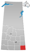
Wauchope, Saskatchewan
Wauchope | |
|---|---|
Municipal | |
| • Governing body | Rural Municipality of Antler |
| • MP | Robert Kitchen |
| • MLA | Dan D'Autremont |
| Population (2010) | |
| • Total | 3 |
| Time zone | CST |
| Postal code | S0C 2P0 |
| Area code | 306 |
| Highways | Highway 13 |
Wauchope (pronounced "walk-up") is an
Antler No. 61
.
Today the community is home to approximately five families. Still standing is the Catholic Church and
baseball diamond is also maintained. Also present is a working grain elevator
.
It is believed that most of the town residents dispersed after the local well went dry but this has yet to be confirmed.[citation needed] Wauchope is now a semi-ghost town.
See also
References
- ^ Saskatchewan, Cory Toth - Encyclopedia Of. "The Encyclopedia of Saskatchewan | Details". esask.uregina.ca. Retrieved November 3, 2016.

