
Stoughton, Saskatchewan
Stoughton | ||
|---|---|---|
Town | ||
Town Manager Chris Miskolczi | | |
| • Governing body | Stoughton Town Council | |
| Area | ||
| • Land | 3.41 km2 (1.32 sq mi) | |
| Population (2011) | ||
| • Total | 649 | |
| • Density | 173.4/km2 (449/sq mi) | |
| Time zone | CST | |
| Postal code | S0G 4T0 | |
| Area code | 306 | |
| Highways | Highway 13 Highway 33 Highway 47 | |
| Website | http://stoughtonsk.ca | |
| [1][2] | ||
Stoughton is a town in Saskatchewan, Canada. In 2011 it had a population of 649.[3] Stoughton was originally called New Hope. The tiny settlement of New Hope was barely three years old when the Canadian Pacific Railway (CPR) arrived in this part of the province in 1904. The CPR chose a location a little to the south for its closest depot, which it called Stoughton. The community of New Hope soon moved to join it.
Stoughton used to have its own small police service, which was aptly named the Stoughton Police Service. It no longer exists and now the Royal Canadian Mounted Police (RCMP) provide policing services to the town and surrounding areas.
Stoughton is approximately eighty-eight miles southeast of Regina at the terminus for highway 33, which is the longest straight road in Canada, and the fifth longest in the world.[4] It is also the administrative headquarters of the Ocean Man First Nations band government.[5] They contain three nations which are Assiniboine, Saulteaux, and Cree.
The town is served by Highway 13, Highway 33, and Highway 47.
Demographics
In the 2021 Census of Population conducted by Statistics Canada, Stoughton had a population of 652 living in 314 of its 378 total private dwellings, a change of 0.5% from its 2016 population of 649. With a land area of 3.45 km2 (1.33 sq mi), it had a population density of 189.0/km2 (489.5/sq mi) in 2021.[6]
| 2016 | 2011 | |
|---|---|---|
| Population | 649 (-6.5% from 2011) | 694 (6.3% from 2006) |
| Land area | 3.74 km2 (1.44 sq mi) | 3.41 km2 (1.32 sq mi) |
| Population density | 173.4/km2 (449/sq mi) | 203.2/km2 (526/sq mi) |
| Median age | 47.8 (M: 48.1, F: 47.7) | 43.4 (M: 42.4, F: 44.4) |
| Private dwellings | 337 (total) | 325 (total) |
| Median household income |
Gallery
-
 Road and grain elevator
 -
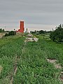
 Grain elevator
 -
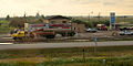 Rest stop
 -
 The tourist Info Centre and golf clubhouse
 -
 Stoughton golf course and grain elevator
 -
 Both of Stoughton's grain elevators alongside the railway


See also
- List of communities in Saskatchewan
- List of towns in Saskatchewan
- List of golf courses in Saskatchewan
References
- ^ National Archives, Archivia Net. "Post Offices and Postmasters". Retrieved 26 May 2014.
- ^ Government of Saskatchewan, MRD Home. "Municipal Directory System". Retrieved 26 May 2014.
- ^ "Census Profile, 2016 Census, Statistics Canada - Validation Error".
- ^ "top 5 longest straight roads". 24 May 2017.
- ^ http://www.sicc.sk.ca/archive/bands/bocean.html [dead link]
- ^ "Population and dwelling counts: Canada, provinces and territories, census divisions and census subdivisions (municipalities), Saskatchewan". Statistics Canada. 9 February 2022. Retrieved 1 April 2022.
- 2016 Canadian Census. Statistics Canada. 12 August 2021. Retrieved 24 June 2012.
- 2011 Canadian Census. Statistics Canada. 21 March 2019. Retrieved 24 June 2012.
- 2006 Canadian Census. Statistics Canada. 20 August 2019.
- 2001 Canadian Census. Statistics Canada. 18 July 2021.
External links
 Media related to Stoughton, Saskatchewan at Wikimedia Commons
 Canada portal
| Cities |  | ||||
|---|---|---|---|---|---|
| Towns | |||||
Villages | |||||
| Rural municipalities | |||||
| First Nations |
| ||||
| Indian reserves | |||||
| Unincorporated communities |
| ||||
| Authority control databases: National |
|---|