
Ye, Myanmar
Ye
ရေး ရေဝ် | |
|---|---|
Town | |
MST ) |
Ye (
Mawlamyaing-Dawei rail line, and has a seaport. The majority of the people are ethnic Mon people. Ye is a center of Mon language education. As of 2014, it had a population of 34,430.[1]
There was a flood in August 2011 after a torrent of rain (12.6 inches on 1 August). 2,000 houses were flooded and some schools and markets were closed because of it.[2]
Climate
Ye has a tropical monsoon climate (Köppen climate classification Am). Temperatures are hot throughout the year, although maximum temperatures in the monsoon months are depressed by heavy cloud and rain. There is a winter dry season (November–April) and a summer wet season (May–October). Torrential rain falls from June to September, with over 1,200 millimetres (47 in) falling in August alone.
| Climate data for Ye (1991–2020) | |||||||||||||
|---|---|---|---|---|---|---|---|---|---|---|---|---|---|
| Month | Jan | Feb | Mar | Apr | May | Jun | Jul | Aug | Sep | Oct | Nov | Dec | Year |
| Mean daily maximum °C (°F) | 33.5 (92.3) |
34.8 (94.6) |
35.6 (96.1) |
35.9 (96.6) |
33.0 (91.4) |
30.4 (86.7) |
29.5 (85.1) |
29.1 (84.4) |
30.4 (86.7) |
32.6 (90.7) |
33.6 (92.5) |
33.1 (91.6) |
32.6 (90.7) |
| Daily mean °C (°F) | 25.6 (78.1) |
26.4 (79.5) |
27.9 (82.2) |
29.3 (84.7) |
28.2 (82.8) |
26.8 (80.2) |
26.1 (79.0) |
25.9 (78.6) |
26.5 (79.7) |
27.5 (81.5) |
27.3 (81.1) |
26.0 (78.8) |
27.0 (80.6) |
| Mean daily minimum °C (°F) | 17.7 (63.9) |
18.0 (64.4) |
20.2 (68.4) |
22.7 (72.9) |
23.4 (74.1) |
23.1 (73.6) |
22.7 (72.9) |
22.7 (72.9) |
22.7 (72.9) |
22.5 (72.5) |
21.0 (69.8) |
18.8 (65.8) |
20.1 (68.2) |
| Average precipitation mm (inches) | 10.2 (0.40) |
5.7 (0.22) |
30.3 (1.19) |
83.1 (3.27) |
517.0 (20.35) |
1,061.1 (41.78) |
1,320.2 (51.98) |
1,367.6 (53.84) |
813.5 (32.03) |
243.4 (9.58) |
59.7 (2.35) |
6.4 (0.25) |
5,518.1 (217.25) |
| Average precipitation days (≥ 1.0 mm) | 0.8 | 0.4 | 1.9 | 4.5 | 18.0 | 25.6 | 27.8 | 27.6 | 23.0 | 14.6 | 3.8 | 0.8 | 148.9 |
| Source: World Meteorological Organization[3] | |||||||||||||
Gallery
-
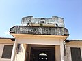 Ye Station
 -
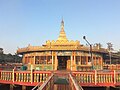 Sasana 2500 Pagoda
 -
 Sakar Taung Pagoda

.jpg)
.jpg)
See also
References
- ^ "Myanmar: Regions, States, Major Cities & Towns - Population Statistics, Maps, Charts, Weather and Web Information". www.citypopulation.de. Retrieved 2021-04-01.
- ^ "Heavy flooding hits Ye; markets and schools closed". www.mizzima.com. Archived from the original on 2011-08-03.
- ^ "World Meteorological Organization Climate Normals for 1991–2020". World Meteorological Organization. Retrieved 16 October 2023.
Capital: Mawlamyine | ||
| Mawlamyine District |  | |
| Thaton District | ||
| Cities, towns, and villages |
| |