
Albion, California
Albion | |
|---|---|
707 | |
| GNIS feature IDs | 1657904;[2] 2628703[4] |

Albion is a census-designated place[6] in Mendocino County, California, United States.[2] It is located 15 miles (24 km) south of Fort Bragg,[7] at an elevation of 174 feet (53 m).[2] Albion had a population of 153 at the 2020 census.[3]
Toponym
Albion was named in 1844, as a reference to when
Geography
Albion lies directly on California's State Route 1 (Shoreline Highway) north of Elk and south of Mendocino and Little River. It lies just north of the intersection of State Route 1 with State Route 128. Albion Ridge Road leads east from the town center. The side roads on Albion Ridge Road are labeled from B through Q.

The nearest beaches include Navarro Beach to the south and Handley Beach at the head of Albion Ridge Road.
Vegetation includes coastal headlands, with
Albion has two bridges, one spanning the Albion River and the other Little Salmon Creek. The Albion River Bridge, built in 1944 when steel and concrete were in short supply, remains as the last wooden bridge still in use on State Route 1.
The ZIP Code is 95410. The community is inside
According to the United States Census Bureau, the CDP covers an area of 1.85 square miles (4.8 km2), of which 0.04 square miles (0.10 km2), or 2.0%, are water.[1]
Schools
The town belongs to the Mendocino Unified School District,[9] and children attend Albion Elementary School or Mendocino K-8 School until third grade, then Mendocino K-8 School and Mendocino High School.[10]
The
Demographics
| Census | Pop. | Note | %± |
|---|---|---|---|
| 2010 | 168 | — | |
| 2020 | 153 | −8.9% | |
| U.S. Decennial Census[12] 1850–1870[13][14] 1880-1890[15] 1900[16] 1910[17] 1920[18] 1930[19] 1940[20] 1950[21] 1960[22] 1970[23] 1980[24] 1990[25] 2000[26] 2010[27] | |||
The
The census reported that 94.1% of the population lived in households, 5.9% lived in non-institutionalized group quarters, and none were institutionalized.
There were 74 households, out of which 20.3% included children under the age of 18, 44.6% were married-couple households, 16.2% were
The age distribution was 6.5% under the age of 18, 9.8% aged 18 to 24, 14.4% aged 25 to 44, 26.1% aged 45 to 64, and 43.1% who were 65 years of age or older. The median age was 60.3 years. There were 80 males and 73 females.
There were 111 housing units at an average density of 61.2 units per square mile (23.6 units/km2), of which 74 (66.7%) were occupied. Of these, 71.6% were owner-occupied, and 28.4% were occupied by renters.[28][29]
Politics
In the
Federally, Albion is in California's 2nd congressional district, represented by Democrat Jared Huffman.[32]
See also
- Albion River Inn
- Fensalden Inn
- Albion River Railroad
References
- ^ a b "2021 U.S. Gazetteer Files: California". United States Census Bureau. Retrieved July 28, 2022.
- ^ a b c d U.S. Geological Survey Geographic Names Information System: Albion
- ^ a b "P1. Race – Albion CDP, California: 2020 DEC Redistricting Data (PL 94-171)". U.S. Census Bureau. Retrieved July 28, 2022.
- ^ U.S. Geological Survey Geographic Names Information System: Albion Census Designated Place
- ^ Navarro Point Preserve and Coastal Trail, Mendocino Land Trust
- ^ U.S. Geological Survey Geographic Names Information System: Albion, California
- ISBN 1-884995-14-4.
- ISBN 978-0-520-21271-8. Retrieved January 20, 2012.
- U.S. Census Bureau. Retrieved April 10, 2024. - Text list
- ^ "Mendocino Unified School District – Schools". Retrieved February 7, 2015.
- ^ "Albion Biological Field Station – a quiet summer place to work, play and learn", Independent Coast Observer, July 20, 2007.
- ^ "Decennial Census by Decade". United States Census Bureau.
- ^ "1870 Census of Population - Population of Civil Divisions less than Counties - California - Almeda County to Sutter County" (PDF). United States Census Bureau.
- ^ "1870 Census of Population - Population of Civil Divisions less than Counties - California - Tehama County to Yuba County" (PDF). United States Census Bureau.
- ^ "1890 Census of Population - Population of California by Minor Civil Divisions" (PDF). United States Census Bureau.
- ^ "1900 Census of Population - Population of California by Counties and Minor Civil Divisions" (PDF). United States Census Bureau.
- ^ "1910 Census of Population - Supplement for California" (PDF). United States Census Bureau.
- ^ "1920 Census of Population - Number of Inhabitants - California" (PDF). United States Census Bureau.
- ^ "1930 Census of Population - Number and Distribution of Inhabitants - California" (PDF). United States Census Bureau.
- ^ "1940 Census of Population - Number of Inhabitants - California" (PDF). United States Census Bureau.
- ^ "1950 Census of Population - Number of Inhabitants - California" (PDF). United States Census Bureau.
- ^ "1960 Census of Population - General population Characteristics - California" (PDF). United States Census Bureau.
- ^ "1970 Census of Population - Number of Inhabitants - California" (PDF). United States Census Bureau.
- ^ "1980 Census of Population - Number of Inhabitants - California" (PDF). United States Census Bureau.
- ^ "1990 Census of Population - Population and Housing Unit Counts - California" (PDF). United States Census Bureau.
- ^ "2000 Census of Population - Population and Housing Unit Counts - California" (PDF). United States Census Bureau.
- ^ "2010 Census of Population - Population and Housing Unit Counts - California" (PDF). United States Census Bureau.
- ^ "Albion CDP, California; DP1: Profile of General Population and Housing Characteristics - 2020 Census of Population and Housing". US Census Bureau. Retrieved March 31, 2025.
- ^ "Albion CDP, California; P16: Household Type - 2020 Census of Population and Housing". US Census Bureau. Retrieved March 31, 2025.
- ^ "Senators". State of California. Retrieved March 10, 2013.
- ^ "Members Assembly". State of California. Retrieved March 2, 2013.
- ^ "California's 2nd Congressional District - Representatives & District Map". Civic Impulse, LLC. Retrieved March 1, 2013.
External links
Municipalities and communities of Mendocino County, California, United States | ||
|---|---|---|
| Cities | 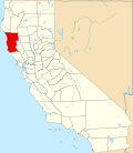 | |
| CDPs | ||
| Unincorporated communities |
| |
| Indian reservations |
| |
| Former settlements | ||
| Footnotes | ‡This populated place also has portions in an adjacent county or counties | |
| ||
| International | |
|---|---|
| National | |
| Other | |