
Amboy Crater
| Amboy Crater | |
|---|---|
US
| |
| Topo map | USGS Amboy Crater[3] |
| Geology | |
| Mountain type | Cinder cone[2] |
| Last eruption | About 10,000 Years Ago[4] |
| Climbing | |
| Easiest route | Trail[1][5][6] |
| Designated | May 1973 |


Amboy Crater is a
It is about 75 miles (120 km) equidistant from Barstow to the west and Needles to the east, and 1.5 miles (2.4 km) south of historic U.S. Route 66, near the town of Amboy in San Bernardino County. In 1973, Amboy Crater was designated the Amboy Crater National Natural Landmark.[2][7]

Location
The crater's location is 2.5 miles (4.0 km) southwest of the town of
Description
This
The crater is 944 ft (288 m) above sea level, about 250 ft (76 m) above the surrounding
Visiting
-
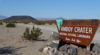 Amboy Crater National Landmark sign

The Federal Bureau of Land Management (BLM) recommends using the Western Cone Trail to reach the volcano peak's rim, a steep and rocky hiking trail.[1] The trailhead is at the Amboy Crater day-use parking area, which provides shaded and open picnic tables and public restrooms. Regular desert precautions apply here: being alert for rattlesnakes and old military explosives, and having a hat, sunscreen, sturdy shoes and abundant drinking water. Educational and organized groups are advised to contact the BLM before going to Amboy Crater.[2][4][10]
Media
Amboy Crater was used as a location in the 1959 movie Journey to the Center of the Earth, with matte paintings used to alter the shape of the cone and place it within the landscape of Iceland. Fires were set inside the crater to simulate a volcanic eruption. Amboy Crater was also featured in the Viceland network show Abandoned, Season 1, episode 6: "Route 66". In HBO's From the Earth to the Moon Apollo 15 episode, Amboy Crater is overflown during astronaut training as a stand-in for the terrain of the San Francisco Volcanic Field outside of Flagstaff, AZ.[citation needed]
See also
- Lavic Lake volcanic field
- Cima Dome & Volcanic Field National Natural Landmark
- Roy's Motel and Café
References
- ^ a b c "Amboy Recreation Site" (PDF). BLM/CA/GI-2000/014+8322 REV. 6/07. Bureau of Land Management. June 2007. Archived from the original (PDF) on 2016-03-08. Retrieved 2016-03-03.
- ^ a b c d e "Amboy Crater National Natural Landmark". Needles Field Office. Bureau of Land Management. 2008-04-22. Archived from the original on 2008-09-17. Retrieved 2016-03-03.
- ^ a b "Amboy Crater". Geographic Names Information System. United States Geological Survey, United States Department of the Interior. Retrieved 2014-12-28.
- ^ a b c d e "Amboy Crater" (PDF). BLM/CA/GI-2000/014+8322 REV. 6/07. Bureau of Land Management. June 2007. Archived from the original (PDF) on 12 October 2008. Retrieved 3 March 2016.
- ISBN 978-0-89997-389-0.
- ISBN 978-1-930193-26-0.
- ^ "National Natural Landmark Summary". National Park Service. February 5, 2004. Archived from the original on 7 May 2009. Retrieved 2016-03-03.
- .
- ^ http://alliance.la.asu.edu/rockart/vmltest/PhillipsMojaveTest.pdf Archived 2014-02-22 at the Wayback Machine . accessed 3/25/2013
- ^ BLM Needles Field Office: telephone number - 1 760 326 7000 (to ensure adequate group parking availability)
External links
 Media related to Amboy Crater at Wikimedia Commons
- "Amboy". Global Volcanism Program. Smithsonian Institution. Retrieved 2021-06-28.
- Amboy Crater National Natural Landmark at the Bureau of Land Management website