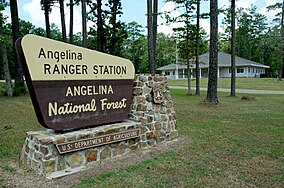
Angelina National Forest
| Angelina National Forest | |
|---|---|
 | |
| Location | Texas, USA |
| Nearest city | Lufkin, TX |
| Coordinates | 31°16′07″N 94°24′43″W / 31.26861°N 94.41194°W |
| Area | 153,180 acres (619.9 km2)[1] |
| Established | October 13, 1936[2] |
| Governing body | U.S. Forest Service |
| Website | National Forests in Texas |


Angelina National Forest is a
shortleaf pine
are dominant species in the northern portion and abundant throughout.
History
Humans came to the area around 8,000 years ago. Archeological sites document the evidence of man's presence over the entire period since then.
In 1934, the
resolution to urge federal purchase of land to create National Forests in Texas. In 1935, acquisition began on the Davy Crockett, Sam Houston, Sabine
and Angelina National Forests.
Wildlife
Hundreds of wildlife species exist in the forest. Principal game species include white-tailed deer, squirrel, wild turkey, American woodcock, bobwhite quail, mourning dove and wood duck. The forest provides wintering habitat for the bald eagle. The red-cockaded woodpecker, an endangered species, is found throughout the forest.[3]
Wilderness areas
There are two officially designated
wilderness areas lying within Angelina National Forest that are part of the National Wilderness Preservation System
.
See also
- Texas Forest Trail
- List of U.S. National Forests
References
- ^ a b c "Land Areas of the National Forest System" (PDF). U.S. Forest Service. Retrieved 2012-03-20.
- ^ "The National Forests of the United States" (PDF). ForestHistory.org. Retrieved July 30, 2012.
- ^ "RED-COCKADED WOODPECKER". The Texas Breeding Bird Atlas. Retrieved 2022-04-11.
External links
Wikimedia Commons has media related to Angelina National Forest.
- Angelina National Forest USDA Forest Service - National Forests & Grasslands in Texas
- Christopher Long: Angelina National Forest from the Handbook of Texas Online. Retrieved December 23, 2008.

