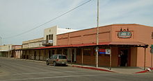
Arizona State Route 287
Route map:
| ||||
|---|---|---|---|---|
| Location | ||||
| Country | United States | |||
| State | Arizona | |||
| Counties | Pinal | |||
| Highway system | ||||
| ||||
| ||||

State Route 287, also known as SR 287, is a predominantly east–west state highway in central Arizona. Originally, this highway number only applied to Florence-Coolidge Highway; the branch to Casa Grande was added later.
Route description
SR 287 begins in
History
The route between Florence and Coolidge was numbered as SR 287 in 1932. At that time, it was an unpaved road.[3] By 1934, it was paved in the segment it was designated.[4] In 1961, the section to Casa Grande was added to the designation.[5]
Junction list
The entire route is in Pinal County.
| Location | mi[1] | km | Destinations | Notes | |
|---|---|---|---|---|---|
San Diego | Western terminus of SR 287; southern terminus of SR 387; eastern terminus of SR 84; SR 387 is former SR 93 | ||||
| 4.08 | 6.57 | I-10 exit 194 | |||
| | 14.08 | 22.66 | West end of SR 87 concurrency | ||
| Coolidge | 22.66 | 36.47 | East end of SR 87 concurrency | ||
Historic US 80) – Florence Historic District , Business District | Eastern terminus | ||||
1.000 mi = 1.609 km; 1.000 km = 0.621 mi
| |||||
References
- ^ a b c Roadway Inventory Management Section, Multimodal Planning Division (December 31, 2021). "2021 State Highway System Log" (PDF). Arizona Department of Transportation. Retrieved June 5, 2023.
- ^ Google (June 5, 2023). "overview map of SR 287" (Map). Google Maps. Google. Retrieved June 5, 2023.
- Arizona Highway Department. 1932. Retrieved March 30, 2012.
- ^ Condition Map of State Highway System (Map). Arizona State Highway Department. 1934. Retrieved March 30, 2012.
- ^ Road Map of Arizona (Map). Cartography by Rand McNally. Arizona State Highway Department. 1963. Retrieved March 30, 2012.
External links
KML is from Wikidata
