
Ashwood, Oregon
Ashwood, Oregon | |
|---|---|
541 | |
| Coordinates and elevation from United States Geological Survey[2] |
Ashwood is a ghost town in Jefferson County, Oregon, United States, 32 miles (51 km) northeast of Madras.[3][4]
Ashwood was named for its proximity to Ash Butte, a butte with volcanic ash deposits on its sides, and to honor Whitfield T. Wood, who settled in the area in the 1870s. Ashwood post office was established in 1898.[1]
The Ashwood area was first used by the
ranching and agriculture as the mainstays of their economy.[6]
Ashwood is popular with
rockhounds, as the area has an abundance of petrified wood, jasper, and thundereggs—Oregon's state rock.[7]
Climate
This region experiences warm (but not hot) and dry summers, with no average monthly temperatures above 71.6 °F. According to the
Köppen Climate Classification system, Ashwood has a warm-summer Mediterranean climate, abbreviated "Csb" on climate maps.[8]
Gallery
-
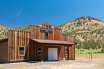 Ash Butte Grange #802
 -
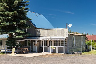 Post office, Ashwood, 97711
 -
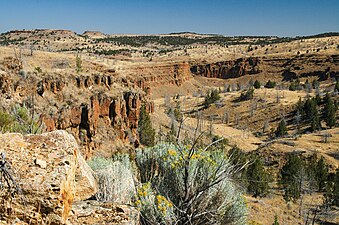 Rock formations near Ashwood
 -
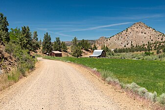 Farm on Trout Creek Rd., Ashwood


See also
References
- ^ ISBN 0-87595-277-1.
- ^ "Ashwood". Geographic Names Information System. United States Geological Survey, United States Department of the Interior. November 28, 1980. Retrieved August 6, 2011.
- ISBN 0-87108-500-3.
- OCLC 2713643.
- ^ "Horse Heaven Mine & Ghost Town". Active and Abandoned Railroads of the Pacific Northwest. Retrieved March 6, 2009.
- ^ "Ashwood, 1915". Oregon Historical Society. Retrieved March 6, 2009.
- ^ "Oregon Collecting Sites". Bob's Rock Shop. Archived from the original on January 31, 2009. Retrieved March 6, 2009.
- ^ Climate Summary for Ashwood, Oregon
External links
- Communities: Ashwood Archived April 17, 2010, at the Wayback Machine – Madras-Jefferson County Chamber of Commerce
Municipalities and communities of Jefferson County, Oregon, United States | ||
|---|---|---|
| Cities |  | |
| CDPs | ||
| Other communities | ||
| Indian reservation | ||
| Ghost towns | ||
| Footnotes | ‡This populated place also has portions in an adjacent county or counties | |
| ||
| International | |
|---|---|
| National | |