
Burkesville, Kentucky
Burkesville, Kentucky | ||
|---|---|---|
FIPS code 21-11098 | | |
| GNIS feature ID | 0488433 | |
| Website | www | |
Burkesville is a
History
Burkesville began as a small riverside settlement even before the Iroquois Indians officially sold the land in 1768. The settlement was originally called Cumberland Crossing. In 1846, it was incorporated as a city and named Burkesville after Isham Burk, a prominent citizen leader at that time.
Just as Kentucky was a border state in the Civil War, so was Burkesville a border town. Burkesville stood on the Cumberland River, a major natural barrier between opposing forces, so Union and Confederate troops as well as guerillas led by Champ Ferguson sparred across the countryside. Confederate General John Hunt Morgan tore through the area while conducting Morgan's Raid, and Confederate General Hylan B. Lyon's raids in December 1864 burned seven courthouses, ending with the one in Burkesville on January 3.
Burkesville was a fairly busy river port whose heyday came during the latter part of the nineteenth century, when water transportation was the most feasible way to move large quantities of goods. The rise of larger craft, such as the riverboat, required diligent dredging of the riverbed to keep it navigable so far upstream. The last steamboat docked in Burkesville in 1929, the year after the first major road was opened to the larger city of Glasgow, 40 miles (64 km) to the west. The river's head of commercial navigation moved from Burnside (which has a railroad) to Burkesville (which does not) when the U.S. Army Corps of Engineers began building Wolf Creek Dam without a lock about 25 miles upstream before World War II. The dam controlled flooding that had plagued the town from its beginning, but was the last nail in the coffin of commercial navigation. The corps' impoundment of Dale Hollow Reservoir in 1944 gave the town a tourist and fishing trade, and development of a trout fishery on the river from the dam to Burkesville has also provided a small economic boost, as has development of Dale Hollow Lake State Resort Park.
Burkesville had a pack horse library serving rural residents in the late 1930s and early 1940s.[7]
Today the main routes of access to the city are State
Geography
Burkesville is located at 36°47′34″N 85°22′10″W / 36.79278°N 85.36944°W (36.792787, -85.369578).[8]
According to the United States Census Bureau, the city has a total area of 2.64 square miles (6.85 km2), of which 2.57 square miles (6.65 km2) is land and 0.08 square miles (0.20 km2), or 2.90%, is water.[6]
Climate
The climate in this area is characterized by hot, humid summers and generally mild to cool winters. According to the
Demographics
| Census | Pop. | Note | %± |
|---|---|---|---|
| 1810 | 106 | — | |
| 1840 | 340 | — | |
| 1850 | 369 | 8.5% | |
| 1880 | 434 | — | |
| 1910 | 817 | — | |
| 1920 | 798 | −2.3% | |
| 1930 | 886 | 11.0% | |
| 1940 | 1,092 | 23.3% | |
| 1950 | 1,278 | 17.0% | |
| 1960 | 1,688 | 32.1% | |
| 1970 | 1,717 | 1.7% | |
| 1980 | 2,051 | 19.5% | |
| 1990 | 1,815 | −11.5% | |
| 2000 | 1,756 | −3.3% | |
| 2010 | 1,521 | −13.4% | |
| 2020 | 1,388 | −8.7% | |
| 2022 (est.) | 1,380 | [10] | −0.6% |
| U.S. Decennial Census[11] | |||
As of the
There were 768 households, out of which 27.2% had children under the age of 18 living with them, 36.5% were married couples living together, 19.1% had a female householder with no husband present, and 40.2% were non-families. 37.0% of all households were made up of individuals, and 18.8% had someone living alone who was 65 years of age or older. The average household size was 2.15 and the average family size was 2.79.
In the city, the population was spread out, with 22.9% under the age of 18, 7.7% from 18 to 24, 23.5% from 25 to 44, 22.7% from 45 to 64, and 23.1% who were 65 years of age or older. The median age was 42 years. For every 100 females, there were 76.5 males. For every 100 females age 18 and over, there were 69.5 males.
The median income for a household in the city was $17,209, and the median income for a family was $24,028. Males had a median income of $20,985 versus $16,763 for females. The
Education
Burkesville has a lending library, the Cumberland County Public Library.[13]
Notable residents
- Two Preston H. Leslie, were born in the part of Cumberland County that later became Clinton County.[14]
- Thomas Lincoln, father of the 16th President Abraham Lincoln, served two terms as constable of Cumberland County from 1802 to 1804. He was also commissioned an ensign of the Cornstalk Militia of Cumberland County.[15]
- David L. Williams, judge of the Kentucky 40th Circuit Court, former President of the Kentucky Senate, 1992 Republican candidate for U.S. Senate, and the 2011 Republican gubernatorial nominee.
References
- ^ "2020 U.S. Gazetteer Files". United States Census Bureau. Retrieved March 18, 2022.
- ^ "Annual Estimates of the Resident Population for Incorporated Places in Kentucky: April 1, 2020 to July 1, 2022". United States Census Bureau. Retrieved May 26, 2023.
- ^ "Annual Estimates of the Resident Population for Incorporated Places in Kentucky: April 1, 2020 to July 1, 2022". United States Census Bureau. Retrieved May 26, 2023.
- ^ "Summary and Reference Guide to House Bill 331 City Classification Reform" (PDF). Kentucky League of Cities. Retrieved December 30, 2014.
- ^ "Find a County". National Association of Counties. Archived from the original on May 31, 2011. Retrieved June 7, 2011.
- ^ a b "Geographic Identifiers: 2010 Demographic Profile Data (G001): Burkesville city, Kentucky". U.S. Census Bureau, American Factfinder. Archived from the original on February 12, 2020. Retrieved August 13, 2014.
- ^ "Pack Horse Library". Kingsport Times. November 8, 1938. Retrieved September 3, 2017 – via Newspapers.com.
- ^ "US Gazetteer files: 2010, 2000, and 1990". United States Census Bureau. February 12, 2011. Retrieved April 23, 2011.
- ^ Climate Summary for Burkesville, Kentucky
- ^ "Annual Estimates of the Resident Population for Incorporated Places in Kentucky: April 1, 2020 to July 1, 2022". United States Census Bureau. Retrieved May 26, 2023.
- ^ "Census of Population and Housing". Census.gov. Retrieved June 4, 2015.
- ^ "U.S. Census website". United States Census Bureau. Retrieved January 31, 2008.
- ^ "Kentucky Public Library Directory". Kentucky Department for Libraries and Archives. Archived from the original on January 11, 2019. Retrieved June 5, 2019.
- ^ "Area History". Burkesville Kentucky Online. 2007 Archived October 29, 2009, at the Wayback Machine
- ^ State historical plaque located in Burkesville, Kentucky Archived October 30, 2009, at the Wayback Machine
External links
- City of Burkesville official website
- Cumberland County News
- Cumberland County Public Library[permanent dead link]
- Cumberland County Tourism & Convention Commission
Municipalities and communities of Cumberland County, Kentucky, United States | ||
|---|---|---|
| City | 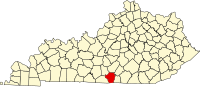 | |
| CDP | ||
| Other unincorporated communities | ||
| ||
| International | |
|---|---|
| National | |
| Other | |