
Cumberland County, Kentucky
Cumberland County | |
|---|---|
UTC−5 (CDT) | |
| Congressional district | 1st |
| Website | explorecumberlandcounty |
Cumberland County is a
History
Cumberland County was created in 1798 from land given by Green County.[5] In 1829, the first commercial oil well in the United States was dug three miles north of Burkesville. It is usually not recognized as a commercial well because the drillers were looking for salt brine, but the oil was bottled and sold.
It was the first county in the United States to elect a female sheriff, Pearl Carter Pace.
Burkesville is the first town downstream from Wolf Creek Dam, so it is considered flood-proof, but there have been concerns about leaks at the dam. The U.S. Army Corps of Engineers completed repairs in 2013.
Geography
According to the
Adjacent counties
- Adair County (north)
- Russell County (northeast)
- Clinton County (east)
- Clay County, Tennessee (south)
- Monroe County (west)
- Metcalfe County (northwest)
Demographics
| Census | Pop. | Note | %± |
|---|---|---|---|
| 1800 | 3,284 | — | |
| 1810 | 6,191 | 88.5% | |
| 1820 | 8,058 | 30.2% | |
| 1830 | 8,624 | 7.0% | |
| 1840 | 6,090 | −29.4% | |
| 1850 | 7,005 | 15.0% | |
| 1860 | 7,340 | 4.8% | |
| 1870 | 7,690 | 4.8% | |
| 1880 | 8,894 | 15.7% | |
| 1890 | 8,452 | −5.0% | |
| 1900 | 8,962 | 6.0% | |
| 1910 | 9,846 | 9.9% | |
| 1920 | 10,648 | 8.1% | |
| 1930 | 10,204 | −4.2% | |
| 1940 | 11,923 | 16.8% | |
| 1950 | 9,309 | −21.9% | |
| 1960 | 7,835 | −15.8% | |
| 1970 | 6,850 | −12.6% | |
| 1980 | 7,289 | 6.4% | |
| 1990 | 6,784 | −6.9% | |
| 2000 | 7,147 | 5.4% | |
| 2010 | 6,856 | −4.1% | |
| 2020 | 5,888 | −14.1% | |
| 2023 (est.) | 6,000 | [7] | 1.9% |
| U.S. Decennial Census[8] 1790-1960[9] 1900-1990[10] 1990-2000[11] 2010-2021[12] | |||
As of the
There were 2,976 households, out of which 29.40% had children under the age of 18 living with them, 53.00% were married couples living together, 11.20% had a female householder with no husband present, and 31.50% were non-families. 28.90% of all households were made up of individuals, and 14.50% had someone living alone who was 65 years of age or older. The average household size was 2.37 and the average family size was 2.89.
In the county, the population was spread out, with 23.60% under the age of 18, 6.90% from 18 to 24, 26.80% from 25 to 44, 24.80% from 45 to 64, and 17.90% who were 65 years of age or older. The median age was 40 years. For every 100 females there were 92.70 males. For every 100 females age 18 and over, there were 89.10 males.
The median income for a household in the county was $21,572, and the median income for a family was $28,701. Males had a median income of $21,313 versus $16,548 for females. The
Ancestry/ethnicity
As of 2017 the largest self-identified ancestry groups/ethnic groups in Cumberland County, Kentucky were:[14]
| Largest ancestries (2017) | Percent |
|---|---|
| English | 32.8% |
| "American" | 15.7% |
Irish |
10.2% |
| German | 4.4% |
Scots-Irish |
1.1% |
Italian |
1.1% |
Scottish |
1.1% |
French (except Basque) |
1.0% |
| Polish | 0.9% |
Communities
City
- Burkesville (county seat)
Census-designated place
Other unincorporated places
Politics
Like all of the heavily Unionist eastern Pennyroyal, a region of largely small farms that did not rely heavily on slavery, Cumberland County provided an exceptionally large number of soldiers for the Union Army during the Civil War.
The last Democrat to carry Cumberland County at the Presidential level was
| Year | Republican | Democratic | Third party | |||
|---|---|---|---|---|---|---|
| No. | % | No. | % | No. | % | |
| 2020 | 2,769 | 83.68% | 508 | 15.35% | 32 | 0.97% |
| 2016 | 2,502 | 81.60% | 459 | 14.97% | 105 | 3.42% |
| 2012 | 2,216 | 77.65% | 599 | 20.99% | 39 | 1.37% |
| 2008 | 2,056 | 73.51% | 697 | 24.92% | 44 | 1.57% |
| 2004 | 2,356 | 72.74% | 848 | 26.18% | 35 | 1.08% |
| 2000 | 2,220 | 73.85% | 736 | 24.48% | 50 | 1.66% |
| 1996 | 1,654 | 62.13% | 753 | 28.29% | 255 | 9.58% |
| 1992 | 1,866 | 60.96% | 917 | 29.96% | 278 | 9.08% |
| 1988 | 2,231 | 74.49% | 753 | 25.14% | 11 | 0.37% |
| 1984 | 2,729 | 77.77% | 766 | 21.83% | 14 | 0.40% |
| 1980 | 2,216 | 71.92% | 821 | 26.65% | 44 | 1.43% |
| 1976 | 1,653 | 65.41% | 853 | 33.76% | 21 | 0.83% |
| 1972 | 2,294 | 76.42% | 686 | 22.85% | 22 | 0.73% |
| 1968 | 2,116 | 67.82% | 646 | 20.71% | 358 | 11.47% |
| 1964 | 1,794 | 56.70% | 1,348 | 42.60% | 22 | 0.70% |
| 1960 | 2,697 | 76.25% | 840 | 23.75% | 0 | 0.00% |
| 1956 | 2,584 | 71.76% | 1,000 | 27.77% | 17 | 0.47% |
| 1952 | 2,426 | 72.44% | 909 | 27.14% | 14 | 0.42% |
| 1948 | 1,947 | 69.31% | 794 | 28.27% | 68 | 2.42% |
| 1944 | 2,619 | 78.27% | 717 | 21.43% | 10 | 0.30% |
| 1940 | 2,533 | 74.30% | 872 | 25.58% | 4 | 0.12% |
| 1936 | 2,127 | 69.40% | 935 | 30.51% | 3 | 0.10% |
| 1932 | 2,369 | 65.53% | 1,235 | 34.16% | 11 | 0.30% |
| 1928 | 2,593 | 82.79% | 538 | 17.18% | 1 | 0.03% |
| 1924 | 2,143 | 69.60% | 918 | 29.81% | 18 | 0.58% |
| 1920 | 2,380 | 71.60% | 931 | 28.01% | 13 | 0.39% |
| 1916 | 1,394 | 67.60% | 653 | 31.67% | 15 | 0.73% |
| 1912 | 972 | 56.91% | 577 | 33.78% | 159 | 9.31% |
Cumberland County was a dry county prior to a special election held June 28, 2016, where the measure passed 1,441 votes to 1,069 votes.
Notable people
- William M. Branham, American Christian minister and faith healer who initiated the post–World War II healing revival.
- Cumberland County was the birthplace of Joel Cheek who later made Maxwell House coffee.[18]
- Governor of Montana[19]
- David L. Williams, judge of the Kentucky 40th Circuit Court, former President of the Kentucky Senate, 1992 Republican candidate for U.S. Senate, and the 2011 Republican gubernatorial nominee
See also
- Morgan's Raid
- National Register of Historic Places listings in Cumberland County, Kentucky
- Cumberland River
- Dale Hollow Lake
References
- ^ "Census - Geography Profile: Cumberland County, Kentucky". United States Census Bureau. Retrieved December 30, 2022.
- ^ "Find a County". National Association of Counties. Archived from the original on May 31, 2011. Retrieved June 7, 2011.
- ^ Gannett, Henry (1905). The Origin of Certain Place Names in the United States. Govt. Print. Off. pp. 97.
- ^ The Register of the Kentucky State Historical Society, Volume 1. Kentucky State Historical Society. 1903. pp. 35.
- ^ Collins, Lewis (1882). Collins' Historical Sketches of Kentucky: History of Kentucky, Volume 2. Collins & Company. p. 26.
- ^ "2010 Census Gazetteer Files". United States Census Bureau. August 22, 2012. Archived from the original on August 12, 2014. Retrieved August 13, 2014.
- ^ "Annual Estimates of the Resident Population for Counties: April 1, 2020 to July 1, 2023". United States Census Bureau. Retrieved March 14, 2024.
- ^ "U.S. Decennial Census". United States Census Bureau. Retrieved August 13, 2014.
- ^ "Historical Census Browser". University of Virginia Library. Archived from the original on August 11, 2012. Retrieved August 13, 2014.
- ^ "Population of Counties by Decennial Census: 1900 to 1990". United States Census Bureau. Retrieved August 13, 2014.
- ^ "Census 2000 PHC-T-4. Ranking Tables for Counties: 1990 and 2000" (PDF). United States Census Bureau. Archived (PDF) from the original on March 27, 2010. Retrieved August 13, 2014.
- ^ "State & County QuickFacts". United States Census Bureau. Archived from the original on June 7, 2011. Retrieved March 6, 2014.
- ^ "U.S. Census website". United States Census Bureau. Retrieved January 31, 2008.
- ^ a b "American FactFinder - Results". Archived from the original on February 13, 2020. Retrieved May 25, 2019.
- ^ Copeland, James E.; ‘Where Were the Kentucky Unionists and Secessionists’; The Register of the Kentucky Historical Society, volume 71, no. 4 (October 1973), pp. 344-363
- ^ VOTER REGISTRATION STATISTICS REPORT; Kentucky Secretary of State
- ^ Leip, David. "Dave Leip's Atlas of U.S. Presidential Elections". uselectionatlas.org. Retrieved July 1, 2018.
- ISBN 978-0-7385-6819-5.
- ^ "Montana Governor Edwin Lee Norris". National Governors Association. Archived from the original on December 2, 2012. Retrieved October 10, 2012.
External links
Municipalities and communities of Cumberland County, Kentucky, United States | ||
|---|---|---|
| City | 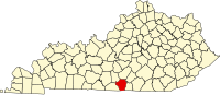 | |
| CDP | ||
| Other unincorporated communities | ||
| ||
36°47′N 85°23′W / 36.78°N 85.39°W
| International | |
|---|---|
| National | |
| Other | |