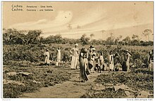
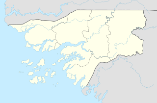
Cacheu
Cacheu | |
|---|---|
 Fortress of Cacheu | |
| Coordinates: 12°16′14″N 16°09′57″W / 12.27056°N 16.16583°W | |
| Country | |
| Region | Cacheu Region |
| Captaincy founded and fort built | 1588 |
| Incorporated (town) | 1605 |
| Elevation | 44 m (144 ft) |
| Population (2009 census) | |
| • Total | 9,882 |
Cacheu is a town in northwestern Guinea-Bissau lying on the Cacheu River, capital of the eponymous region. Its population was estimated to be 9,849 as of 2008[update].[1]
Etymology
The town of Cacheu is situated in territory of the Papel people. The name is of Bainuk origin: Caticheu, meaning 'the place where we rest'.[2]
History
Cacheu was one of the earliest European colonial settlements in sub-saharan Africa, due to its strategic location on the
In 1567 the English slaver John Hawkins raided the settlement.[4] Due to such threats and a period of social conflict with their hosts the Papels, in 1589 the traders sought and received permission from the king of Cacheu to build a fort. They then abandoned the town and moved en masse into the new stockade in 1591 in an attempt to avoid the control of the local government.[5] The Papels unsuccessfully stormed the fort before an agreement was reached allowing cohabitation.[6] The fort did not have a secure water supply, however, and the locals used their control over water to pressure the Portuguese into trade concessions.[7]

In 1598 a resident priest was appointed, and in 1605 the settlement was offered a municipal charter by the Portuguese crown.[8][9] At this time the settlement had around 1500 inhabitants, of whom 500 were white.[10] A new fort, which still stands today, was built of stone in the 1640s.[9]
Cacheu was an important slave trading point for the Portuguese in the
The condition of the garrison deteriorated progressively from the latter part of the 17th century up through the 19th. In 1878, a reinforced Portuguese force successfully attacked Cacanda in retaliation for the earlier assassination of the captain-major of Cacheu, the first of a series of 'pacification campaigns' that would culminate in the final conquest of the region in 1914. As Portuguese Guinea expanded and solidified, however, towns such as Bolama, Bissau and Canchungo became administrative centers at the expense of Cacheu.[15]
Cacheu Today

Roads in the town are paved with
International relations
Twin towns – Sister cities
Cacheu is
References
- ^ World Gazetteer [dead link], Retrieved on June 16, 2008
- ISBN 3825877094), p. 57, citing Cissoko, paper presentation at 5th Centenary Conference 'Cacheu, Cidade Antiga', Cacheu, 1988.
- ^ Disney, AR (2009). A History of Portugal and the Portuguese Empire. Vol. 2. Cambridge University Press. pp. 51–55.
- ^ Lobban & Mendy 2013, pp. xi.
- ^ Rodney 1966, pp. 176.
- ^ Rodney 1966, pp. 178.
- ^ Rodney 1966, pp. 263.
- ^ Rodney 1966, pp. 145.
- ^ a b c "Cacheu: Historical Background and Urbanism". HPIP. Archived from the original on 2020-10-01.
- ^ Rodney 1966, pp. 180.
- ^ Rodney 1966, pp. 154.
- ^ Rodney 1966, pp. 283–4.
- ^ Lobban & Mendy 2013, pp. 75.
- ^ Rodney 1966, pp. 457–64.
- ^ Lobban & Mendy 2013, pp. 77.
- ^ Britannica, The Editors of Encyclopaedia. "Cacheu". Encyclopedia Britannica, 31 Oct. 2008, https://www.britannica.com/place/Cacheu-Guinea-Bissau. Accessed 27 July 2023.
- ^ "Lisboa - Geminações de Cidades e Vilas" [Lisbon - Twinning of Cities and Towns]. Associação Nacional de Municípios Portugueses [ National Association of Portuguese Municipalities] (in Portuguese). Archived from the original on 2015-02-01. Retrieved 2013-08-23.
- ^ "Acordos de Geminação, de Cooperação e/ou Amizade da Cidade de Lisboa" [Lisbon - Twinning Agreements, Cooperation and Friendship]. Camara Municipal de Lisboa (in Portuguese). Archived from the original on 2013-10-31. Retrieved 2013-08-23.
Sources
- Lobban, Richard Andrew Jr.; Mendy, Peter Karibe (2013). Historical Dictionary of the Republic of Guinea-Bissau (4th ed.). Lanham: Scarecrow Press. ISBN 978-0-8108-5310-2.
- Rodney, Walter (May 1966). A History of the Upper Guinea Coast, 1545-1800 (PDF) (Thesis). ProQuest.

