
Camaligan
Camaligan | |
|---|---|
| Municipality of Camaligan | |
 | |
 Flag | |
| Etymology: Tagalog: kamalig + an ("place of sheds") | |
| Nickname: The Small Town with a Big Heart | |
| Anthem: Camaligan Kong Namomótan My Beloved Camaligan | |
 Map of Camarines Sur with Camaligan highlighted | |
OpenStreetMap  | |
.svg) Camaligan Location within the Philippines | |
| Coordinates: 13°37′15″N 123°09′56″E / 13.6208°N 123.1656°E | |
| Country | Philippines |
| Region | Bicol Region |
| Province | Camarines Sur |
| District | 3rd district |
Founded | 1795
1900 (Annexed to Nueva Caceres), 1909 (re-independence) |
| Barangays | 13 (see |
| • Representative | Gabriel H. Bordado Jr. (Liberal) |
| • Municipal Council | Members |
| • St. Teresa of Calcutta | |
Camaligan, officially the Municipality of Camaligan (
Camaligan is part of the Metro Naga Urban Area.
The town is home to the oldest known pre-colonial site in the
Etymology
The origin of the town and its name can be traced back to the early settlers of the place. Known as the cortadores, or woodcutters, to the early
"Catagbacan" was the oldest known name of Camaligan. Moreover, according to D. Adolfo Puya y Ruiz, in his “Camarines Sur – Descripcion General De Està Provincia En Luzon” (Manila: 1887), Camaligan was called "Kinamaligan" before.[8]
History
Pre-colonial era
The town of Camaligan is a known
Spanish era
The settlers of the religious visita of
On 5 June 1795, a petition to the Spanish religious authorities was sent by the natives and signed by the supposedly officials of the place, to request for a resident
American era
In 1902, the municipality was officially established through an act of the Philippine legislature. It also named
Geography
With an area of 468.8 hectares (1,158 acres), it is the smallest municipality in Camarines Sur, but it is the densest, having an approximation of 5,200 persons per square kilometer,[citation needed] which is almost twice the density of the neighboring City of Naga of 2,456 per square kilometer.[11]
Barangays
Camaligan is politically subdivided into 13
| Barangays | Class | Population[13] | Barangay Head |
|---|---|---|---|
| Dugcal | Rural | 4,464 | Gabriel Jr. DV. Flores |
| Marupit | Rural | 4,510 | Delia B. Mansor |
| San Francisco | Rural | 745 | Eden G. Torallo |
| San Jose-San Pablo (Poblacion) | Rural | 671 | Eden B. Bon |
| San Juan-San Ramon (Poblacion) | Rural | 982 | Emeterio M. Avila |
| San Lucas (Poblacion) | Rural | 578 | Cyril O. Agomaa |
| San Marcos (Poblacion) | Rural | 1,388 | Susana Agna |
| San Mateo (Poblacion) | Rural | 1,508 | Carlos Q. Mariscal, Jr. |
| San Roque | Rural | 3,585 | Rolando P. Marasigan |
| Santo Domingo (Poblacion) | Rural | 618 | Maria Teresa A. Ruiz |
| Santo Tomas (Poblacion) | Rural | 810 | Maria Jasmin M. Trinidad |
| Sua | Rural | 2,154 | Servando Santa Ana |
| Tarosanan | Rural | 2,096 | Marites Salumbides |
Climate
| Climate data for Camaligan, Camarines Sur | |||||||||||||
|---|---|---|---|---|---|---|---|---|---|---|---|---|---|
| Month | Jan | Feb | Mar | Apr | May | Jun | Jul | Aug | Sep | Oct | Nov | Dec | Year |
| Mean daily maximum °C (°F) | 32 (90) |
31 (88) |
34 (93) |
36 (97) |
37 (99) |
37 (99) |
36 (97) |
34 (93) |
35 (95) |
34 (93) |
33 (91) |
32 (90) |
34 (94) |
| Mean daily minimum °C (°F) | 27 (81) |
27 (81) |
29 (84) |
31 (88) |
32 (90) |
32 (90) |
31 (88) |
30 (86) |
30 (86) |
29 (84) |
28 (82) |
28 (82) |
30 (85) |
| Average precipitation mm (inches) | 39.34 (1.55) |
68.7 (2.70) |
26.73 (1.05) |
66.19 (2.61) |
84.49 (3.33) |
178.89 (7.04) |
244.27 (9.62) |
188.3 (7.41) |
160.98 (6.34) |
445.0 (17.52) |
135.5 (5.33) |
367.8 (14.48) |
2,006.19 (78.98) |
| Average rainy days | 16 | 18 | 13 | 15 | 23 | 28 | 30 | 24 | 26 | 27 | 25 | 29 | 274 |
| Source: World Weather Online (Use with caution: this is modeled/calculated data, not measured locally.)[14] | |||||||||||||
Camaligan has a significant amount of rainfall during the year. This is true even for the driest month. According to the Köppen climate classification system, Camaligan has a tropical rainforest climate. The average annual temperature is 27.1 °C in Camaligan. About 2527 mm of precipitation falls annually.[15]
Demographics
| Year | Pop. | ±% p.a. |
|---|---|---|
| 1918 | 2,133 | — |
| 1939 | 3,005 | +1.65% |
| 1948 | 7,362 | +10.47% |
| 1960 | 8,529 | +1.23% |
| 1970 | 7,821 | −0.86% |
| 1975 | 9,853 | +4.74% |
| 1980 | 10,989 | +2.21% |
| 1990 | 15,436 | +3.46% |
| 1995 | 17,411 | +2.28% |
| 2000 | 19,188 | +2.11% |
| 2007 | 20,758 | +1.09% |
| 2010 | 22,254 | +2.56% |
| 2015 | 24,109 | +1.54% |
| 2020 | 25,036 | +0.74% |
| Source: Philippine Statistics Authority[16][17][18][19] | ||
In the 2020 census, the population of Camaligan was 25,036 people, with a density of 5,300 inhabitants per square kilometre or 14,000 inhabitants per square mile.[5]
Economy
Graphs are unavailable due to technical issues. There is more info on Phabricator and on MediaWiki.org. |
Bicol River serves as a natural source of irrigation and fertilization to the town where agriculture is still considered as a major industry.[8]
Out of the 468 hectares total land area, 175 hectares are devoted to rice production, all of which are irrigated and fertilized by the river through its occasional flooding.[8]
Government
Camaligan is being headed by a mayor who is being elected by its residents.
The current mayor of the town is Diano Ibardaloza, Jr.[1] Last May 2022 Election, he has been elected for his first term as the Municipal Mayor.[1]
Since 1902, thirty-one (31) mayors already headed the town.
| Term | Mayor[8] |
|---|---|
| 1902-1903 | Pedro Bustamante |
| 1904-1905 | Quintin Bagsic |
| 1905-1906 | Catalino Alayan |
| 1906-1907 | Fabian Garcia |
| 1908-1909 | Tomas Salvador |
| 1909-1911 | Jose Agapor |
| 1912-1915 | Mauricio Cordial |
| 1916-1919 | Liberato Montiveros |
| 1920-1923 | Antonio Santa Ana |
| 1924-1927 | Pedro Flores |
| 1928-1931 | Vidal Custodio |
| 1932-1935 | Elias Agna de Dios |
| 1936-1941 | Teotimo Rebuquiao |
| 1942-1944 | Felipe Cuadrante |
| 1944 | Glecerio Blas |
| 1945 | Andres Diez |
| 1946-1947 | Julio Capucao |
| 1948-1951 | Francisco A. Aurellano |
| 1952-1955 | Buenaventura Plantado |
| 1956-1963 | Agapito T. Loriaga |
| 1964-1967 | Dalmacio Aurellano |
| 1968-1971 | Agapito T. Loriaga |
| 1972-1986 | Dalmacio Aurellano |
| 1986 | Napoleon Valiente |
| 1986-1987 | Amelito Belen |
| 1987 | Fabian A. Valenciano |
| 1987-1988 | Priscilla T. Aurellano |
| 1988-1995 | Manuel N. Prado |
| 1995-2004 | Rolando C. Eduardo |
| 2004-2007 | Pablo N. Prado |
| 2007-2010 | Rolando C. Eduardo |
| 2010-2013 | Emmanuel T. Prado |
| 2013-2022 | Marilou Marquez-Hirose |
| 2022–Present | Diano S. Ibardaloza, Jr. |
Culture
The people of Camaligan derived their socio-cultural identity as river people from the existence of the river. Bicol River is an important resource for irrigation and fertilization of the land where agriculture and fishing is still considered as a major industry. The place's festivals, songs and dances found their roots and inspiration from the river. Hence, the river ecology has bred its own distinct community.[8]
Festivals
Religious and cultural festivals are being held in the town.
- Kamalig Festival - Camaligan's main festival, which happens from June 5 to 13, in celebration of the town's founding anniversary and the feast of St. Anthony of Padua, the town's patron saint.
- Ati-atihan Festival - a street dance competition and parade inspired by the festival in same name, in honor of Santo Niño, the town's second patron.
- Kamaligang Pasko Festival - a celebration of Christmas wherein the town, most especially its people center and its river park, is being decorated, and a man-sized christmas village is being set-up outside the municipal hall.
Tourism
Santo Domingo Chapel is an old
Sira, or fish, is a small
After the initial launching of Camaligan River Park on 1 June 2014, its tourism industry began to be more active. Its continuous improvements attracted many visitors, mostly coming from the City of Naga, to come and enjoy walking along the riverside.[29]
M/B Camaligan is a
-
 Façade of San Antonio de Padua Parish Church
 -
 Camaligan Hanging Bridge
 -
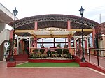 Camaligan River Park's Hall
 -
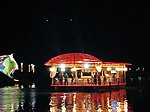 M/B Camaligan passing the Sira
.jpg)


Archaeology
Camaligan is
In a documentary made by GMA News TV, it was found that the artifacts and biofacts were not limited to the town proper. In fact, during a road-widening project conducted in September 2017 by the national government, hundreds of human bone fragments, animal bones, burial and ceremonial jar fragments, and stone tools were found after digging only the edges of the road. The documentary also found many Camaligueños to own artifacts they have found in their own land. Due to these findings, the town's reputation as a vital pre-colonial Ibalon archaeological site was solidified.[30]
Education
Camaligan has one
High school
- senior high schoolis located in barangay Dugcal.
Elementary schools
- Camaligan Central School - the oldest school and the primary elementary schoolof the town.
- Sua Elementary School
- Dugcal Elementary School
- San Roque Elementary School
- Marupit Elementary School
- Tarosanan-San Francisco Elementary School
Preschools
- Hansel & Gretel Day Care Center
- Petite L'e' Tudiant Learning Centre
- Dugcal Day Care Center
- Gogon Day Care Center
- Marupit Day Care Center
- San Francisco Day Care Center
- San Juan Day Care Center
- San Lucas Day Care Center
- San Mateo Day Care Center
- San Roque Day Care Center
- Sua Day Care Center
- Tampac Day Care Center
- Tarosanan Day Care Center
Notable personalities
- Joyce Nocomura - crowned as Miss Philippines Water 2007.[31]
References
- ^ a b c "Halalan 2022 CAMALIGAN, CAMARINES SUR Results". ABS-CBN. 1 July 2022. Retrieved July 1, 2022.
- ^ "Vice mayor ng Camaligan, Camarines Sur, nagbitiw sa pwesto". ABS-CBN. 20 July 2022. Retrieved July 20, 2022.
- (DILG)
- (PDF) from the original on May 25, 2021. Retrieved July 16, 2021.
- ^ a b c Census of Population (2020). "Region V (Bicol Region)". Total Population by Province, City, Municipality and Barangay. Philippine Statistics Authority. Retrieved 8 July 2021.
- ^ "PSA Releases the 2018 Municipal and City Level Poverty Estimates". Philippine Statistics Authority. 15 December 2021. Retrieved 22 January 2022.
- ^ a b c Escandor, Juan Jr."1500-yr-old artifacts found in CamSur". Inquirer.net. 18 August 2017. Retrieved June 16, 2019.
- ^ a b c d e f g h i j Marcaida, Dominador Jr. "Camaligan Town and Municipality History". Academia. 30 September 2016. Retrieved June 16, 2019.
- ^ a b Escandor, Juan Jr."Hispanic burial ground unearthed in Camsur". Lifestyle.inq. 31 July 2017. Retrieved June 16, 2019.
- ^ a b c d "Historic Camaligan". I Know Places. 30 March 2019. Retrieved June 16, 2019.
- ^ Brinkhoff, Thomas (31 October 2017). "Naga: City in Luzon". City Population. Retrieved 16 June 2019.
- ^ "Camaligan:DILG Region V Camarines Sur". DILG Region V. Retrieved 16 June 2019.
- ^ "Countryside in Figures: Camarines Sur 2018". PSA CamSur. 2018. p. 53. Archived from the original on September 1, 2021. Retrieved 12 June 2019.
- ^ "Camaligan, Camarines Sur: Average Temperatures and Rainfall". World Weather Online. Retrieved 29 October 2017.
- ^ "Climate-Data.org". Climate Sahara: Temperature, Climograph, Climate table for Sahara - Climate-Data.org. 9 August 2015. Retrieved 17 February 2019.
- ^ Census of Population (2015). "Region V (Bicol Region)". Total Population by Province, City, Municipality and Barangay. Philippine Statistics Authority. Retrieved 20 June 2016.
- ^ Census of Population and Housing (2010). "Region V (Bicol Region)" (PDF). Total Population by Province, City, Municipality and Barangay. National Statistics Office. Retrieved 29 June 2016.
- ^ Censuses of Population (1903–2007). "Region V (Bicol Region)". Table 1. Population Enumerated in Various Censuses by Province/Highly Urbanized City: 1903 to 2007. National Statistics Office.
{{cite encyclopedia}}: CS1 maint: numeric names: authors list (link) - ^
"Province of Camarines Sur". Municipality Population Data. Local Water Utilities AdministrationResearch Division. Retrieved 17 December 2016.
- ^ "Poverty incidence (PI):". Philippine Statistics Authority. Retrieved December 28, 2020.
- ^ "Estimation of Local Poverty in the Philippines" (PDF). Philippine Statistics Authority. 29 November 2005.
- ^ "2003 City and Municipal Level Poverty Estimates" (PDF). Philippine Statistics Authority. 23 March 2009.
- ^ "City and Municipal Level Poverty Estimates; 2006 and 2009" (PDF). Philippine Statistics Authority. 3 August 2012.
- ^ "2012 Municipal and City Level Poverty Estimates" (PDF). Philippine Statistics Authority. 31 May 2016.
- ^ "Municipal and City Level Small Area Poverty Estimates; 2009, 2012 and 2015". Philippine Statistics Authority. 10 July 2019.
- ^ "PSA Releases the 2018 Municipal and City Level Poverty Estimates". Philippine Statistics Authority. 15 December 2021. Retrieved 22 January 2022.
- ^ "PSA Releases the 2021 City and Municipal Level Poverty Estimates". Philippine Statistics Authority. 2 April 2024. Retrieved 28 April 2024.
- ^ "VISITA IGLESIA IN CAMARINES SUR, PHILIPPINES – 7 CHURCH IN 7 DAYS ITINERARY". Two Monkeys Travel. 2 February 2019. Retrieved 13 June 2019.
- ^ a b "#NCDTravels: Camaligan Floating Restaurant/River Cruise". Naga City Deck. 26 February 2019. Retrieved 13 June 2019.
- ^ "iJuander: Mga kagamitang nagmula sa sinaunang sibilisasyon, namataan sa Camarines Sur". Youtube. GMA Public Affairs. 21 September 2017. Archived from the original on 2021-12-21. Retrieved 16 June 2019.
- ^ "Miss Philippines Earth 2007 Winners". Mukamo. 6 July 2018. Archived from the original on August 24, 2007. Retrieved 18 February 2019.
{{cite web}}: CS1 maint: unfit URL (link)
External links
- Philippine Standard Geographic Code
- Philippine Census Information
- Official Site of the Province of Camarines Sur

| Municipalities | |
|---|---|
| Component city | |
| Independent component city |
|
Statistically grouped with the Province of Camarines Sur | |||||||
| Administrative divisions |
|  | |||||
| Geography | |||||||
| History | |||||||
| Religion |
| ||||||
| Public utilities and services | |||||||
| Transportation |
| ||||||
| Education |
| ||||||
| Landmarks | |||||||
| |||||||