Carnmore
This article needs additional citations for verification. (July 2007) |
Carnmore
An Carn Mór | |
|---|---|
Electoral division | |
IST (WEST)) | |
| Irish Grid Reference | M395288 |
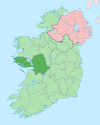
Carnmore (Irish: An Carn Mór)[1] is an electoral area located at the southern end of the parish of Claregalway, approximately 8 miles (13 km) east of Galway city in County Galway, Ireland. Carnmore is in a Gaeltacht area, although the majority of residents use English as their first language.[2] Incorporating the townlands of Carnmore, Carnmore West and Carnmore East, the area is represented in hurling competitions by Carnmore GAA.[3] Galway Airport is also nearby.
History
Archaeological sites in the area include a
Demographics
According to the 2016 census there were 2,577 people living in the Carnmore Electoral Division,[5] with only 2.2% of the population indicating that they spoke Irish on a daily basis outside the education system.[6] As of 2015, there were 164 pupils enrolled in the local primary school, Carnmore National School.[2]
Sport
Carnmore's hurling club, Carnmore GAA, was founded in 1944 – although hurling has been played in the parish since before the foundation of the GAA.[4] The club fields teams in the Galway Intermediate Hurling Championship.
Notable residents
- Máirtín Ó Cadhain was a school teacher in Carnmore in the 1930s.
- All-Ireland Senior Footballmedallist in 1966
References
- ^ "An Carn Mór / Carnmore". logainm.ie. Placenames Database of Ireland. Retrieved 25 August 2021.
- ^ a b "Whole School Evaluation Report - Carnmore National School, School Road, Carnmore, Uaran Mór, Galway" (PDF). education.ie. Department of Education. 23 March 2015. Archived from the original (PDF) on 25 August 2021.
- ^ "Garnmore GAA - About". carnmoregaa.com. Retrieved 25 August 2021.
- ^ a b c d "Carnmore - History". carnmore.net. Archived from the original on 23 September 2015.
- ^ "Sapmap Area - Electoral Division - An Carn Mór". Census 2016. Central Statistics Office. April 2016. Archived from the original on 25 August 2021. Retrieved 25 August 2021.
- ^ "ArcGIS Web Application". census.cso.ie. Archived from the original on 28 November 2017. Retrieved 21 November 2020.

