
Craig County, Oklahoma
Craig County | |
|---|---|
UTC−5 (CDT) | |
| Congressional district | 2nd |
Craig County is a
History
In the early 1800s, this area was part of the hunting grounds of the
Between 1867 and 1870, the U. S. government moved the Shawnee and Delaware tribes into this area from Kansas, another section of Indian Territory. Then the area was assigned as part of the Delaware and Cooweescoowee districts of the Cherokee Nation, Indian Territory, after the US government had made new treaties with the tribes that had allied with the Confederacy during the Civil War.
In 1871, the federal government took Cherokee land for the
Coal mining began in this area after the Civil War. Mine companies used both tunnel and strip mines, but they did not begin major production until about 1900. Production has continued into the 21st century.
Other resource exploitation was based on oil, and the first oil refinery began operations by 1911; it was operated by
The county was organized in 1907, at the Oklahoma Statehood Convention. It was named for Granville Craig, a prominent Cherokee farmer of
Geography
According to the
Major highways
|
|
Adjacent counties
- Labette County, Kansas (north)
- Cherokee County, Kansas (northeast)
- Ottawa County (east)
- Delaware County (southeast)
- Mayes County (south)
- Rogers County (southwest)
- Nowata County (west)
Demographics
| Census | Pop. | Note | %± |
|---|---|---|---|
| 1910 | 17,404 | — | |
| 1920 | 19,160 | 10.1% | |
| 1930 | 18,052 | −5.8% | |
| 1940 | 21,083 | 16.8% | |
| 1950 | 18,263 | −13.4% | |
| 1960 | 16,303 | −10.7% | |
| 1970 | 14,722 | −9.7% | |
| 1980 | 15,014 | 2.0% | |
| 1990 | 14,104 | −6.1% | |
| 2000 | 14,950 | 6.0% | |
| 2010 | 15,029 | 0.5% | |
| 2020 | 14,107 | −6.1% | |
| 2021 (est.) | 14,115 | 0.1% | |
| U.S. Decennial Census[5] 1790-1960[6] 1900-1990[7] 1990-2000[8] 2010[9] | |||

As of the
There were 5,620 households, out of which 30.90% had children under the age of 18 living with them, 57.30% were married couples living together, 9.70% had a female householder with no husband present, and 29.80% were non-families. 27.00% of all households were made up of individuals, and 13.90% had someone living alone who was 65 years of age or older. The average household size was 2.46 and the average family size was 2.97.
In the county, the population was spread out, with 23.90% under the age of 18, 7.80% from 18 to 24, 27.90% from 25 to 44, 24.30% from 45 to 64, and 16.20% who were 65 years of age or older. The median age was 39 years. For every 100 females there were 101.10 males. For every 100 females age 18 and over, there were 98.60 males.
The median income for a household in the county was $30,997, and the median income for a family was $36,499. Males had a median income of $26,704 versus $20,082 for females. The
Politics
| Voter Registration and Party Enrollment as of June 30, 2023[11] | |||||
|---|---|---|---|---|---|
| Party | Number of Voters | Percentage | |||
| Democratic | 2,743 | 33.36% | |||
| Republican | 4,416 | 53.71% | |||
| Others | 1,063 | 12.93% | |||
| Total | 8,222 | 100% | |||
| Year | Republican | Democratic | Third party | |||
|---|---|---|---|---|---|---|
| No. | % | No. | % | No. | % | |
| 2020 | 4,686 | 77.69% | 1,217 | 20.18% | 129 | 2.14% |
| 2016 | 4,283 | 74.04% | 1,252 | 21.64% | 250 | 4.32% |
| 2012 | 3,559 | 67.08% | 1,747 | 32.92% | 0 | 0.00% |
| 2008 | 3,858 | 65.05% | 2,073 | 34.95% | 0 | 0.00% |
| 2004 | 3,894 | 60.86% | 2,504 | 39.14% | 0 | 0.00% |
| 2000 | 2,815 | 51.33% | 2,568 | 46.83% | 101 | 1.84% |
| 1996 | 2,058 | 37.51% | 2,649 | 48.29% | 779 | 14.20% |
| 1992 | 2,106 | 33.86% | 2,780 | 44.70% | 1,333 | 21.43% |
| 1988 | 2,463 | 45.23% | 2,940 | 53.98% | 43 | 0.79% |
| 1984 | 3,629 | 58.63% | 2,515 | 40.63% | 46 | 0.74% |
| 1980 | 2,956 | 49.66% | 2,801 | 47.06% | 195 | 3.28% |
| 1976 | 2,540 | 41.11% | 3,577 | 57.90% | 61 | 0.99% |
| 1972 | 4,163 | 70.36% | 1,642 | 27.75% | 112 | 1.89% |
| 1968 | 2,686 | 44.67% | 2,098 | 34.89% | 1,229 | 20.44% |
| 1964 | 2,541 | 39.83% | 3,838 | 60.17% | 0 | 0.00% |
| 1960 | 3,770 | 57.45% | 2,792 | 42.55% | 0 | 0.00% |
| 1956 | 3,543 | 53.29% | 3,106 | 46.71% | 0 | 0.00% |
| 1952 | 3,830 | 54.99% | 3,135 | 45.01% | 0 | 0.00% |
| 1948 | 2,807 | 40.16% | 4,182 | 59.84% | 0 | 0.00% |
| 1944 | 3,111 | 47.97% | 3,363 | 51.86% | 11 | 0.17% |
| 1940 | 3,582 | 45.24% | 4,316 | 54.52% | 19 | 0.24% |
| 1936 | 2,964 | 40.30% | 4,377 | 59.52% | 13 | 0.18% |
| 1932 | 2,124 | 30.41% | 4,861 | 69.59% | 0 | 0.00% |
| 1928 | 3,511 | 54.48% | 2,897 | 44.96% | 36 | 0.56% |
| 1924 | 2,519 | 43.54% | 3,096 | 53.51% | 171 | 2.96% |
| 1920 | 3,094 | 50.88% | 2,903 | 47.74% | 84 | 1.38% |
| 1916 | 1,647 | 43.99% | 1,901 | 50.77% | 196 | 5.24% |
| 1912 | 1,391 | 42.34% | 1,772 | 53.94% | 122 | 3.71% |
Communities
Cities
- Vinita (county seat)
Towns
Unincorporated communities
NRHP sites
The following sites in Craig County are listed on the National Register of Historic Places:
- Craig County Courthouse, Vinita
- First Methodist Episcopal Church, South, Vinita
- Hotel Vinita, Vinita
- McDougal Filling Station, Vinita
- Randall Tire Company, Vinita
- Spraker Service Station, Vinita
References
- ^ "Craig County, Oklahoma". United States Census Bureau. Retrieved May 11, 2023.
- ^ "Find a County". National Association of Counties. Archived from the original on May 31, 2011. Retrieved June 7, 2011.
- ^ a b c d e Craig County Genealogical Society. "Craig County," Encyclopedia of Oklahoma History and Culture, Retrieved October 28, 2011.
- ^ "2010 Census Gazetteer Files". United States Census Bureau. August 22, 2012. Retrieved February 19, 2015.
- ^ "U.S. Decennial Census". United States Census Bureau. Retrieved February 19, 2015.
- ^ "Historical Census Browser". University of Virginia Library. Archived from the original on August 11, 2012. Retrieved February 19, 2015.
- ^ Forstall, Richard L., ed. (March 27, 1995). "Population of Counties by Decennial Census: 1900 to 1990". United States Census Bureau. Retrieved February 19, 2015.
- ^ "Census 2000 PHC-T-4. Ranking Tables for Counties: 1990 and 2000" (PDF). United States Census Bureau. April 2, 2001. Archived (PDF) from the original on March 27, 2010. Retrieved February 19, 2015.
- ^ "State & County QuickFacts". United States Census Bureau. Archived from the original on June 6, 2011. Retrieved November 8, 2013.
- ^ "U.S. Census website". United States Census Bureau. Retrieved January 31, 2008.
- ^ "Oklahoma Registration Statistics by County" (PDF). OK.gov. January 15, 2019. Archived from the original (PDF) on July 17, 2020. Retrieved February 27, 2019.
- ^ Leip, David. "Dave Leip's Atlas of U.S. Presidential Elections". uselectionatlas.org. Retrieved March 28, 2018.
Further reading
- "Craig County," Vertical File, Research Division, Oklahoma Historical Society, Oklahoma City.
- The Heritage of Craig County and Cooweescoowee and Delaware Districts, Indian Territory, Vol. 3 (Vinita, Okla.: Craig County Genealogical Society, 2000).
- The Story of Craig County: Its People and Places, 2 vols. (Vinita, Okla.: Craig County Heritage Association, 1984–1991).
External links
- Encyclopedia of Oklahoma History and Culture - Craig County
- Oklahoma Digital Maps: Digital Collections of Oklahoma and Indian Territory
Places adjacent to Craig County, Oklahoma | |
|---|---|
Municipalities and communities of Craig County, Oklahoma, United States | ||
|---|---|---|
| City | 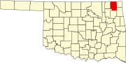 | |
| Towns | ||
| CDP | ||
| Unincorporated community | ||
| Indian reservation | ||
| Footnotes | ‡This populated place also has portions in an adjacent county or counties | |
| ||
36°46′N 95°13′W / 36.76°N 95.22°W
| International | |
|---|---|
| National | |