
Crocker Mountain (Maine)
| Crocker Mountain | |
|---|---|
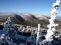
 Crocker Mountain (center) seen from Sugarloaf ski resort | |
| Highest point | |
| Elevation | 4,229 ft (1,289 m) |
| Prominence | 1,214 ft (370 m)[1] |
| Listing | New England 4000 footers |
| Coordinates | 45°02′50″N 70°22′58″W / 45.047167°N 70.382833°W[2] |
| Geography | |
 Crocker Mountain | |
| Topo map | USGS Black Nubble |
Crocker Mountain is a 4,228 ft (1,289 m) peak located in
.A glacial cirque called "Crocker Cirque" is located between the main summit and the lower summit of South Crocker Mountain. Crocker Cirque contains a small pond and can be reached via the Appalachian Trail.
Brooks on the east side of Crocker Mountain feed the
Dead River, another tributary of the Kennebec. The southwest side of Crocker drains into Nash Stream, then into the South Branch
of the Dead River.
Climate
| Climate data for Crocker Mountain 45.0510 N, 70.3816 W, Elevation: 3,976 ft (1,212 m) (1991–2020 normals) | |||||||||||||
|---|---|---|---|---|---|---|---|---|---|---|---|---|---|
| Month | Jan | Feb | Mar | Apr | May | Jun | Jul | Aug | Sep | Oct | Nov | Dec | Year |
| Mean daily maximum °F (°C) | 18.9 (−7.3) |
20.9 (−6.2) |
27.2 (−2.7) |
41.1 (5.1) |
54.1 (12.3) |
63.1 (17.3) |
68.0 (20.0) |
67.0 (19.4) |
60.6 (15.9) |
47.5 (8.6) |
31.6 (−0.2) |
24.7 (−4.1) |
43.7 (6.5) |
| Daily mean °F (°C) | 11.1 (−11.6) |
12.5 (−10.8) |
18.9 (−7.3) |
31.9 (−0.1) |
44.9 (7.2) |
54.2 (12.3) |
59.0 (15.0) |
57.8 (14.3) |
51.0 (10.6) |
38.3 (3.5) |
25.7 (−3.5) |
15.9 (−8.9) |
35.1 (1.7) |
| Mean daily minimum °F (°C) | 3.2 (−16.0) |
4.2 (−15.4) |
10.6 (−11.9) |
22.7 (−5.2) |
35.8 (2.1) |
45.4 (7.4) |
50.0 (10.0) |
48.6 (9.2) |
41.4 (5.2) |
29.2 (−1.6) |
19.9 (−6.7) |
7.1 (−13.8) |
26.5 (−3.1) |
| Average precipitation inches (mm) | 4.06 (103) |
3.43 (87) |
4.22 (107) |
4.85 (123) |
4.52 (115) |
6.61 (168) |
5.43 (138) |
5.15 (131) |
4.90 (124) |
5.87 (149) |
5.00 (127) |
5.16 (131) |
59.2 (1,503) |
| Source: PRISM Climate Group[4] | |||||||||||||
Gallery
-
 Crocker Mountain (center) in winter

See also
References
- ^ "Crocker Mountain, Maine". Peakbagger.com.
- ^ "Crocker Mountain". Geographic Names Information System. United States Geological Survey, United States Department of the Interior.
- ^ "The Crockers". SummitPost.org.
- ^ "PRISM Climate Group, Oregon State University". PRISM Climate Group, Oregon State University. Retrieved October 20, 2023.
To find the table data on the PRISM website, start by clicking Coordinates (under Location); copy Latitude and Longitude figures from top of table; click Zoom to location; click Precipitation, Minimum temp, Mean temp, Maximum temp; click 30-year normals, 1991-2020; click 800m; click Retrieve Time Series button.
This Maine state location article is a stub. You can help Wikipedia by expanding it. |