
D2 motorway (Czech Republic)
This article needs additional citations for verification. (February 2024) |
You can help expand this article with text translated from the corresponding article in Czech. Click [show] for important translation instructions.
|
 | |
|---|---|
| Dálnice D2 | |
 | |
| Route information | |
| Part of | |
| Length | 61 km (38 mi) |
| Major junctions | |
| From | |
| Location | |
| Country | Czech Republic |
| Regions | South Moravian |
| Major cities | Brno |
| Highway system | |
D2 motorway (Czech: Dálnice D2) is a highway in the Czech Republic. It runs from the City of Brno to the border with Slovakia[1] at the Morava river near Lanžhot, from where the Slovak diaľnica D2 leads to Bratislava.
Construction on the D2 highway began in 1974; the first 11 kilometers (6.8 mi) opened in 1978. The last part of the motorway opened in 1980, when it was 141 km (88 mi) long. After the 1993 dissolution of Czechoslovakia, 61 km (38 mi) remain in Czech Republic, 80 km (50 mi) in Slovakia.
Features
| Point | Coordinates (links to map & photo sources) |
|---|---|
| City of Brno | 49°09′45″N 16°37′56″E / 49.162402°N 16.632129°E |
| Village of Starovičky | 48°54′34″N 16°46′50″E / 48.909380°N 16.780531°E |
| Border with Slovakia at the Morava river | 48°41′10″N 16°59′14″E / 48.686175°N 16.987238°E |
Images
-
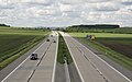 D2 motorway near Blučina

See also
- Motorway D2 (Slovakia)
Referemces
External links
![]() Geographic data related to D2 motorway (Czech Republic) at OpenStreetMap
Geographic data related to D2 motorway (Czech Republic) at OpenStreetMap
This Czech road or road transport-related article is a stub. You can help Wikipedia by expanding it. |