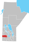
Erickson, Manitoba
This article needs additional citations for verification. (October 2018) |
Erickson is an unincorporated urban community in the
The community was originally established as a Canadian National railway point in 1905. When a post office was opened in 1908 it was known as Avesta. It was named after a town in south-central Sweden. Shortly after, the post office was moved near the railway station site, Erickson Station. The station had been named after the Postmaster, E. Albert Erickson.
Demographics
In the 2021 Census of Population conducted by Statistics Canada, Erickson had a population of 473 living in 231 of its 268 total private dwellings, a change of 2.6% from its 2016 population of 461. With a land area of 1.29 km2 (0.50 sq mi), it had a population density of 366.7/km2 (949.7/sq mi) in 2021.[2]
References
- ^ Goldsborough, Gordon (26 March 2017). "Manitoba Communities: Erickson (Unincorporated Town)". Manitoba Historical Society. Retrieved 15 October 2018.
- ^ "Population and dwelling counts: Canada and designated places". Statistics Canada. February 9, 2022. Retrieved Sep 3, 2022.
External links
50°29′53″N 99°54′41″W / 50.49806°N 99.91139°W

