
Eshtaol
Eshtaol
אֶשְׁתָּאוֹל اشتأول | |
|---|---|
 | |
 Eshtaol  Eshtaol | |
| Coordinates: 31°46′52″N 35°0′36″E / 31.78111°N 35.01000°E | |
| District | |
| Founded | 8000 BCE (Earliest settlement) 1200 BCE (Israelite settlement) 1600s or earlier (Arab village) 1949 (Israeli moshav) |
| Population (2022)[1] | |
| • Total | 1,191 |
| Website | www.eshtaol.org.il |
Eshtaol (
first Book of Chronicles. Located 6 km (4 mi) north of Beit Shemesh,[2] it falls under the jurisdiction of Mateh Yehuda Regional Council. In 2022, it had a population of 1,191.[1]
History
Antiquity
In 2013, archaeological excavations conducted by the
Judean Hills, dating back to the first permanent human settlement in the area some 10,000 years ago.[3][4] Excavations at the site continued into 2014, led by A. Yaroshevich on behalf of the Israel Antiquities Authority.[5]
Biblical era
Eshtaol was in the territory allotted to the
Mahaneh Dan (the camp of Dan), the district "between Zorah and Eshtaol" (Judges 13:25). After his death in Gaza, Samson's body was brought back for burial in the tomb of his fatherManoah between Eshtaol and Zorah (Judges 16:31). Five scouts from Eshtaol and Zorah were sent out to find a land suitable for the tribe of Dan. (Judges 18:1–29).[6]
Modern Eshtaol
Modern Eshtaol was founded on the lands of the depopulated
Jerusalem Corridor to create a contiguous bloc between the coastal plain and Jerusalem. The first residents were Jewish immigrants from Yemen, who settled there in December 1949. They worked in land reclamation and forestry. The Jewish National Fund (JNF) established a 45-dunam
nursery in Eshtaol to supply saplings for JNF forests. Later, the moshav branched out into poultry and other agricultural enterprises. At the end of the 1990s, the moshav absorbed 100 new families.
Gallery
-
 Eshtaol
 -
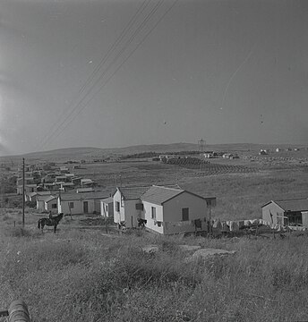 Eshtaol, 1957. Boris Carmi, Meitar collection, National Library of Israel


See also
References
- ^ a b "Regional Statistics". Israel Central Bureau of Statistics. Retrieved 21 March 2024.
- Route 38
- ^ Hasson, Nir (25 November 2013). "Rare, 10,000-year-old Structure Emerges From Judean Hills". Haaretz. Retrieved 2 May 2019.
- ^ Israel Antiquities Authority, Excavators and Excavations Permit for Year 2013, Survey Permit # A-6869. The excavation was led by archaeologists Amir Golani, Ron Beeri, Jacob Vardi, and Benjamin Eliezer Storchan on behalf of Israel Antiquities Authority (IAA).
- ^ Israel Antiquities Authority, Excavators and Excavations Permit for Year 2014, Survey Permit # A-7163
- ^ Eshtaol – Walking in Their Sandals – location profile
- ^ Harel Brigade report from the diary of operations of Operation Danny Palmach (in Hebrew)
- ISBN 0-88728-224-5.
Bibliography
- Golani, Amir (27 November 2008): Eshta’ol, Hadashot Arkheologiyot – Excavations and Surveys in Israel, No. 120.
- Solimany, Gideon (11/03/2009): Eshta’ol Junction, Hadashot Arkheologiyot – Excavations and Surveys in Israel, No. 121.
- Golani, Amir and Dan Storchan (1 January 2009): Eshta’ol, Hadashot Arkheologiyot – Excavations and Surveys in Israel, No. 121.
- Freikman, Michael (23 July 2010): Eshta’ol, Hadashot Arkheologiyot – Excavations and Surveys in Israel, No. 122.
- Storchan, Dan (20 December 2010): Eshta’ol, Survey of Sha‘ar Ha-Gāy–Hartuv Junctions, Hadashot Arkheologiyot – Excavations and Surveys in Israel, No. 122.
- Storchan, Dan (22 November 2012): Eshta’ol, Hadashot Arkheologiyot – Excavations and Surveys in Israel, No. 124.
External links
Wikimedia Commons has media related to Eshtaol.
- Moshav website (in Hebrew)