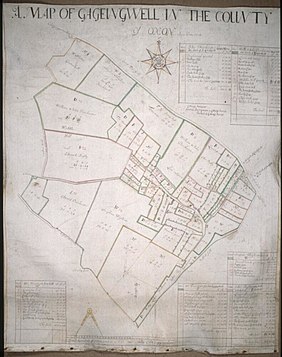
Gagingwell
| Gagingwell | ||
|---|---|---|
Shire county | ||
| Region | ||
| Country | England | |
| Sovereign state | United Kingdom | |
| Post town | Chipping Norton | |
| Postcode district | OX7 | |
| Dialling code | 01608 | |
| Police | Thames Valley | |
| Fire | Oxfordshire | |
| Ambulance | South Central | |
| UK Parliament | ||
| Website | EnstoneVillage.co.uk | |
Gagingwell is a
springs that give rise to a brook, which flows southwards almost 1 mile (1.6 km) to join the River Glyme just downstream of the hamlet of Radford
.
History
In the late
B4030. In 1848 Gagingwell's population was reckoned to be 57 people.[4]

References
- ISBN 0-14-071045-0.
- ^ Historic England (30 August 1988). "Wayside Cross (1052803)". National Heritage List for England. Retrieved 12 August 2011.
- ^ Crossley, Alan (ed.); Baggs, A.P.; Colvin, Christina; Colvin, H.M.; Cooper, Janet; Day, C.J.; Selwyn, Nesta; Tomkinson, A. (1983). A History of the County of Oxford, Volume 11: Wootton Hundred (northern part). Victoria County History. pp. 75–81.
{{cite book}}:|first1=has generic name (help) - ^ Lewis, Samuel, ed. (1931) [1848]. A Topographical Dictionary of England (Seventh ed.). London: Samuel Lewis. pp. 275–279.

