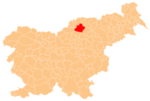
Graška Gora
Graška Gora | |
|---|---|
Slovenj Gradec | |
| Area | |
| • Total | 4.25 km2 (1.64 sq mi) |
| Elevation | 667.5 m (2,190.0 ft) |
| Population (2002) | |
| • Total | 91 |
| [1] | |
Graška Gora (pronounced Styria. The entire municipality is now included in the Carinthia Statistical Region.[3]
The local
Saint Helena and belongs to the Parish of Šmiklavž. The earliest phases of the building date to the 13th century.[4]
References
- ^ Statistical Office of the Republic of Slovenia
- ^ K. K. Statistischen Central-Commission (1883). Orts-Repertorien der im Oesterreichischen Reichsrathe Vertretenen Königreiche und Lander. IV. Steiermark. Vienna: K. K. Statistischen Central-Commission. p. 260.
- ^ Slovenj Gradec municipal site
- ^ Slovenian Ministry of Culture register of national heritage reference number ešd 3186
External links

