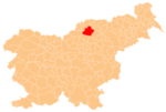
Tomaška Vas
Tomaška Vas | |
|---|---|
Slovenj Gradec | |
| Area | |
| • Total | 3.99 km2 (1.54 sq mi) |
| Elevation | 463.5 m (1,520.7 ft) |
| Population (2002) | |
| • Total | 139 |
| [1] | |
Tomaška Vas (pronounced Styria. The entire municipality is now included in the Carinthia Statistical Region.[2]
The local church from which the settlement gets its name is dedicated to Saint Thomas and belongs to the Parish of Šmartno pri Slovenj Gradcu. It was first mentioned in documents dating to 1375.[3]

