
Granville, North Dakota
Granville, North Dakota | ||
|---|---|---|
FIPS code 38-32660 | | |
| GNIS feature ID | 1029218[5] | |
Granville is a city in
History
Granville was laid out and platted in 1900.[6] The city was named in honor of Granville M. Dodge, a railroad man.[7] The railroad was extended to Granville in 1904, and the city was incorporated in 1906.[8]
In the late 1990s, the town agreed to temporarily change its name to McGillicuddy City, in a promotion for Dr. McGillicuddy's schnapps.[9]
Geography
Granville is located at 48°16′0″N 100°50′36″W / 48.26667°N 100.84333°W (48.266566, -100.843355).[10]
According to the United States Census Bureau, the city has a total area of 0.28 square miles (0.73 km2), all land.[11]
Demographics
| Census | Pop. | Note | %± |
|---|---|---|---|
| 1910 | 455 | — | |
| 1920 | 394 | −13.4% | |
| 1930 | 450 | 14.2% | |
| 1940 | 443 | −1.6% | |
| 1950 | 404 | −8.8% | |
| 1960 | 400 | −1.0% | |
| 1970 | 282 | −29.5% | |
| 1980 | 281 | −0.4% | |
| 1990 | 236 | −16.0% | |
| 2000 | 286 | 21.2% | |
| 2010 | 241 | −15.7% | |
| 2020 | 240 | −0.4% | |
| 2022 (est.) | 230 | [4] | −4.2% |
| U.S. Decennial Census[12] 2020 Census[3] | |||
2010 census
As of the
There were 109 households, of which 28.4% had children under the age of 18 living with them, 45.9% were married couples living together, 10.1% had a female householder with no husband present, 3.7% had a male householder with no wife present, and 40.4% were non-families. 37.6% of all households were made up of individuals, and 18.3% had someone living alone who was 65 years of age or older. The average household size was 2.21 and the average family size was 2.91.
The median age in the city was 44.3 years. 21.6% of residents were under the age of 18; 5.4% were between the ages of 18 and 24; 24.6% were from 25 to 44; 28.6% were from 45 to 64; and 19.9% were 65 years of age or older. The gender makeup of the city was 50.2% male and 49.8% female.
2000 census
As of the
There were 120 households, out of which 34.2% had children under the age of 18 living with them, 55.8% were married couples living together, 6.7% had a female householder with no husband present, and 35.8% were non-families. 30.0% of all households were made up of individuals, and 17.5% had someone living alone who was 65 years of age or older. The average household size was 2.38 and the average family size was 3.04.
In the city, the population was spread out, with 26.6% under the age of 18, 8.4% from 18 to 24, 24.5% from 25 to 44, 19.9% from 45 to 64, and 20.6% who were 65 years of age or older. The median age was 38 years. For every 100 females, there were 108.8 males. For every 100 females age 18 and over, there were 100.0 males.
The median income for a household in the city was $24,444, and the median income for a family was $28,500. Males had a median income of $27,500 versus $14,464 for females. The
Climate
This
Granville North Dakota holds 12 hour temperature rise record [14]
In 12 hours: 83 °F, Granville, N.D., Feb. 21, 1918, from –33 °F to 50 °F from early morning to late afternoon.
Historic Places

The Granville State Bank, on Main Street, was built in 1903 and is listed on the National Register of Historic Places.
Transportation
Amtrak’s Empire Builder, which operates between Seattle/Portland and Chicago, passes through the town on BNSF tracks, but makes no stop. The nearest station is located in Minot, 23 miles (37 km) to the west.
References
- ^ https://www.granvillend.net/about
- ^ "ArcGIS REST Services Directory". United States Census Bureau. Retrieved September 20, 2022.
- ^ a b c "Explore Census Data". American FactFinder. United States Census Bureau. Retrieved November 29, 2023.
- ^ a b "City and Town Population Totals: 2020-2022". United States Census Bureau. November 29, 2023. Retrieved November 29, 2023.
- ^ "US Board on Geographic Names". United States Geological Survey. October 25, 2007. Retrieved January 31, 2008.
- ISBN 978-0-8166-1347-2.
- ISBN 978-1-62376-033-5.
- ^ "History". NODAK.info. Retrieved October 22, 2015.
- ^ "N.D. town changing its name for shot at schnapps money". Lawrence Journal-World. February 13, 1998. pp. 6E. Retrieved October 22, 2015.
- ^ "US Gazetteer files: 2010, 2000, and 1990". United States Census Bureau. February 12, 2011. Retrieved April 23, 2011.
- ^ "US Gazetteer files 2010". United States Census Bureau. Archived from the original on January 12, 2012. Retrieved June 14, 2012.
- ^ United States Census Bureau. "Census of Population and Housing". Retrieved October 30, 2013.
- ^ Climate Summary for Granville, North Dakota
- ^ "Some Outstanding Temperature Rises". Infoplease.
External links
Municipalities and communities of McHenry County, North Dakota, United States | ||
|---|---|---|
| Cities | 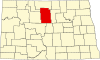 | |
| Townships |
| |
| Unorganized territory | ||
| Other communities | ||
| Indian reservation | ||
| Footnotes | ‡This populated place also has portions in an adjacent county or counties | |
| ||
| International | |
|---|---|
| National | |