
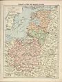
Grobiņas apriņķis


Grobiņas apriņķis (
History
Created as the Captaincy of Grobiņa (German: Hauptmannschaft Grobin) of the Duchy of Courland and Semigallia. After incorporation into the Russian Empire it was merged with southwestern parts of District of Pilten in 1819 to become part of the Chief Captaincy of Aizpute (German: Overhauptmannschaft Hasenpoth). In 1864, County of Grobiņa (Kreis Grobin) became one of the ten counties of the Courland Governorate.
After establishment of the Republic of Latvia, the Grobiņas apriņķis[1] was renamed to Liepājas apriņķis in 1920. On 27 March 1921 the Parish of Palanga was transferred to Lithuania.
In 1949, the Council of Ministers of the Latvian SSR had split Liepājas apriņķis into the newly created districts (rajons) of Liepāja, Priekule (dissolved 1959) and Aizpute (dissolved 1962).
Demographics
At the time of the
Subdivisions (1912)
| Latvian | German | Russian | |
|---|---|---|---|
| Bārtas | Oberbartau | Обербартауская | |
| Durbes | Durben | Дурбенская | |
| Gaviezes | Gawesen | Гавезенская | |
| Grobiņas | Grobin | Гробинская | |
| Medzes-Vērgales | Medsen-Virginahlen | Медзен-Вирцниленская | |
| Nīcas | Niederbartau | Нидербартауская | |
| Palangas | Polangen | Полангенская | |
| Pērkones | Perkuhnen | Перкуненская | |
| Priekules | Preekuln | Прекульнская | |
| Rucavas | Rutzau | Рутцауская | |
| Tadaiķu | Tadaiken | Тадайкенская | |
| Talsu | Talsen | Тальсенская | |
| Vecpils | Altenburg | Альтенбургская |
Palanga as a part of Grobin County
-
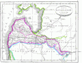
 1820 Polangen in Kurland
 -
 1835 Polangen not in Kurland
 -
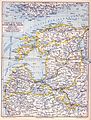 Map of Baltic governorates, Meyers, ca. mid of 1890s - Polangen in Kurland
 -
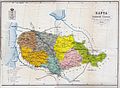
 Map of Kurland and Kowno governorates ca 1900 - Polangen in Kurland
 -
 Map of Kowno G. and surrounding area 1876 - 1914 - Polangen in Kurland
 -
 1888 - Polangen in Kurland
 -
 1902 - Polangen in Kurland
 -
 1910 - Polangen in Kurland
 -
 Map of Ober Ost, WWI - Polangen in Kurland
 -
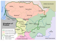
 1920 map of Poland and the Balitcs - Polangen in Kurland


.jpg)


References
- ^ "Letonika.lv. Vārdnīcas - Latviešu—angļu vārdnīca. Apriņķis = district or county". www.letonika.lv. Retrieved 2019-10-14.
- ^ "Первая всеобщая перепись населения Российской Империи 1897 г. Распределение населения по родному языку и уездам 50 губерний Европейской России" (in Russian). Демоскоп Weekly. Retrieved 22 December 2013.
External links
| International | |
|---|---|
| National | |