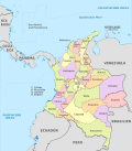
Guainía Department
Department of Guainía
Departamento de Guainía | |
|---|---|
|
UTC-05 | |
| ISO 3166 code | CO-GUA |
| HDI (2019) | 0.670[3] medium · 32nd of 33 |
| Year | Pop. | ±% |
|---|---|---|
| 1964 | 3,602 | — |
| 1973 | 6,637 | +84.3% |
| 1985 | 12,345 | +86.0% |
| 1993 | 28,478 | +130.7% |
| 2005 | 35,230 | +23.7% |
| 2018 | 48,114 | +36.6% |
| Source:[4] | ||
Guainía (Spanish pronunciation: Arawak family). There are a total of 24 ethnic groups in the department; many of them speak four Indigenous languages besides Spanish and Portuguese.
Municipalities
There are two municipalities in Guainía: Inírida, its capital, and Barranco Minas. The rest of the territory is subdivided in corregimientos departamentales, a pending figure due to public disorder[clarification needed].[5] This case happens only in Amazonas, Vaupés and Vichada. Barranco Minas is the second biggest population and a municipality since 2019;[6] it is located on the Guaviare River.
The Guainía corregimientos are:
References
- ^ "DANE". Archived from the original on November 13, 2009. Retrieved February 13, 2013.
- ^ "Producto Interno Bruto por departamento", www.dane.gov.co
- ^ "Sub-national HDI - Area Database - Global Data Lab". hdi.globaldatalab.org. Retrieved 2018-09-13.
- ^ "Reloj de Población". DANE. Departamento Administrativo Nacional de Estadísitica. Archived from the original on 16 January 2018. Retrieved 6 July 2017.
- ^ "Sentencia C-141/01" (in Spanish). Retrieved 2008-07-27.[permanent dead link]
- ^ "Barrancominas nace como el municipio 1.103 de Colombia". www.guainia.gov.co (in European Spanish). Retrieved 2021-09-19.
External links
- (in Spanish) Guainía Secretary of Education
- Territorial-Environmental Information System of Colombian Amazon SIAT-AC website Archived 2020-06-17 at the Wayback Machine

