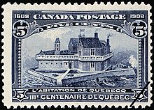
Habitation de Québec
You can help expand this article with text translated from the corresponding article in French. (December 2012) Click [show] for important translation instructions.
|

Habitation de Québec was an ensemble of buildings interconnected by
Vieux-Québec. It was located near the site of the abandoned First Nations village of Stadacona that Jacques Cartier had visited during 1535. It served as a fort and as dwellings for the new colony in New France.[1]

References
- ^ "Samuel de Champlain and the Founding of Quebec". The Canadian Encyclopedia. Retrieved 7 October 2019.
