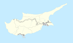
Haspolat
Haspolat
Μια Μηλιά (Greek) | |
|---|---|
| Coordinates: 35°12′17.77″N 33°25′17.34″E / 35.2049361°N 33.4214833°E | |
| Country (de jure) | |
| • District | Nicosia District |
| Country (de facto) | |
| • District | Lefkoşa District |
| Population (2011)[2] | |
| • Total | 4,204 |
Haspolat or Mia Milia (
water treatment plant
are located within its boundaries.
Mia Milia is recorded as early as the early 13th century in papal documents.[3]
In 1973, Mia Milia had an all-
Greek Cypriot population of 1,381. As of 2011, it had a population of 4,204, comprising Turkish Cypriots and Turkish nationals. Migrant workers have set up a shanty town near the industrial area.[4]
Notable people
- Sotiris Kaiafas, Cypriot retired footballer and European Golden Boot winner.
References
- ^ In 1983, the Turkish Republic of Northern Cyprus unilaterally declared independence from the Republic of Cyprus. The de facto state is not recognised by any UN state except Turkey.
- ^ "KKTC 2011 Nüfus ve Konut Sayımı" [TRNC 2011 Population and Housing Census] (PDF). TRNC State Planning Organization. 6 August 2013. p. 16. Archived from the original (PDF) on 6 November 2013.
- ^ Papacostas, Tasos (2012). "Byzantine Nicosia: 650-1191". In Michaelides, D. (ed.). Historic Nicosia. Nicosia: Rimal Publications. p. 87.
- PRIO Cyprus Centre. Archived from the originalon 12 October 2018. Retrieved 20 October 2014.


