
Heidenheim, Bavaria
Heidenheim | |
|---|---|
.svg) Coat of arms | |
Location of Heidenheim within Weißenburg-Gunzenhausen district 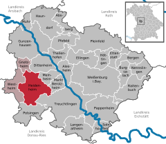 | |
Ortsteile | |
| Government | |
| • Mayor (2020–26) | Susanne Feller[1] |
| Area | |
| • Total | 52.29 km2 (20.19 sq mi) |
| Elevation | 529 m (1,736 ft) |
| Population (2022-12-31)[2] | |
| • Total | 2,619 |
| • Density | 50/km2 (130/sq mi) |
| Time zone | UTC+01:00 (CET) |
| • Summer (DST) | UTC+02:00 (CEST) |
| Postal codes | 91719 |
| Dialling codes | 09833 |
| Vehicle registration | WUG |
| Website | Markt Heidenheim am Hahnenkamm |
Heidenheim (German pronunciation: [ˈhaɪdn̩ˌhaɪm] ⓘ) is a municipality in the Weißenburg-Gunzenhausen district, in Bavaria, Germany.
Heidenheim is an old German market town, which resides in the
Middle Franconia in the middle of Bavaria. It belongs to the rural district called Weißenburg-Gunzenhausen
.
It is the administrative center of the local region called Hahnenkamm.
Geography
Heidenheim is located in the administration region West Middle Franconia (Westmittelfranken). Following local subdistricts belong to Heidenheim: Degersheim, Hechlingen am See, Hohentrüdingen.
History
Heidenheim was first mentioned in the year 742. During that time the
Hohenzollern). After that, Heidenheim belonged to the Margrave of Ansbach. Due to the Reformation
, the monastery was closed in 1537. Since then Heidenheim is mostly Lutheran.
In 1792 Prussia bought principality of Ansbach and henceforth Heidenheim. As part of Ansbach Heidenheim was transferred back to Bavaria due to the contract of Paris (February 1806) to Bavaria.
See also
- Heidenheim Abbey, a former Benedictine foundation
References
- Bayerisches Landesamt für Statistik, 15 July 2021.
- ^ Genesis Online-Datenbank des Bayerischen Landesamtes für Statistik Tabelle 12411-003r Fortschreibung des Bevölkerungsstandes: Gemeinden, Stichtag (Einwohnerzahlen auf Grundlage des Zensus 2011) (Hilfe dazu).
- ^ Proksch, Nikola (1997). "The Anglo-Saxon Missionaries on the Continent". Monks of England: The Benedictines in England from Augustine to the Present Day. Society for Promoting Christian Knowledge. pp. 37–54.
External links
Towns and municipalities in Weißenburg-Gunzenhausen | ||
|---|---|---|
| International | |
|---|---|
| National | |
| Geographic | |