
Imperial College Road
 Imperial College Road from Exhibition Road | |
| Former name(s) | Imperial Institute Road[1] |
|---|---|
| Namesake | Imperial College London |
| Location | Albertopolis, Westminster, London, United Kingdom |
| Postal code | SW7 |
| Nearest Tube station | Imperial Institute, Royal College of Science ) |
Imperial College Road is a tree-lined road in South Kensington, London, England.[2][3] It runs east–west with Queen's Gate to the west and Exhibition Road to the east.
The road forms part of the boundary between
Sir Alexander Fleming Building, and the Science Museum. Beyond these buildings is the Natural History Museum
.
-
 Aerial view from the south. Imperial College Road runs left–right in front of the Queen's Tower in the centre of the view
 -
 Royal College of Science on Imperial Institute Road
 -
 Falmouth Gate looking towards Queen's Gate
 -
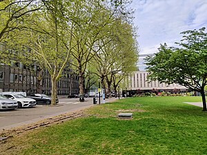 The road runs along Queen's Lawn
 -
 From the corner with Unwin Road looking west
 -
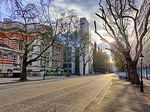
 West end at Queen's Gate looking east


See also
References
- ^ Ordnance Survey. "IV.16 (City Of Westminster; Kensington; Paddington)" (1914). London (1915- Numbered sheets). National Library of Scotland. Retrieved 21 Dec 2019.
- ^ a b "South Kensington Campus" (PDF). UK: Imperial College London. Retrieved 21 September 2015.
- ^ "Imperial College Road". LondonTown.com. Retrieved 21 September 2015.