
Jamaica Pond
| Jamaica Pond | |
|---|---|
kettle pond | |
| Primary outflows | Muddy River |
| Surface area | 68 acres (28 ha) |
| Max. depth | 53 feet (16 m) |
Jamaica Pond is a
The pond has an area of about 68 acres (28 ha), and is 53 feet (16 m) deep at its center (MassWildlife map), making it the largest body of fresh water in Boston, and the largest natural freshwater body in the lower Charles River watershed. It is ringed by a 1.5-mile (2.4 km) walking path, and is an extremely popular destination for Bostonians for walking, fishing, rowing, and sailing. Around Halloween each year, the pond serves as the site for The Lantern Parade. Participants dress in their Halloween costumes and walk around the pond.
The pond once served as a reservoir for the City of Boston and the Town of West Roxbury, and it supplied ice in the winter to Boston and beyond.[1]
According to the
The pond's setting, Jamaica Park, was included in the Olmsted Park landscape complex that was placed on the National Register of Historic Places on December 8, 1971.[3]
History
The Jamaica Plain Ice Company employed 350 men in 1874, and harvested as much 5,000 tons of ice a day from Jamaica Pond.[4]
The pond was once the site of a popular annual winter skating carnival. In 1929, this carnival was cancelled by Mayor Curley when cracks appeared on the ice, and 50,000 skaters had to be evacuated.[5] In recent years, ice skating is no longer permitted on the pond.
Overlooking Jamaica Pond until its 2007 demolition was Pinebank Mansion, the summer home of Edward Newton Perkins.
Gallery
-
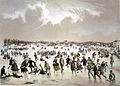 Skating on the pond, 1859
 -
 Ice delivery van, 1890
 -
 Swans, 2010
 -
 Sailboat on pond, 2013
 -
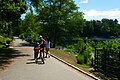
 Bicyclists, 2021
 -
 Walking path, 2021
 -
 Fishing, 2021
 -
 Rowboat, 2021
 -
 Renting a sailboat, 2021
.jpg)


References
- Water resources and the urban environment, lower Charles River Watershed; ISBN 1-4289-8365-1
- Weiskel, Peter K.; Barlow, Lora K.; Smieszek, Tomas W. (2005). "Water Resources and the Urban Environment, Lower Charles River Watershed, Massachusetts, 1630–2005" (PDF). Reston, Virginia: U.S. Geological Survey. Retrieved February 4, 2014.
- ^ "Harvesting Ice on Jamaica Pond". Jamaica Plain Historical Society. Retrieved 13 June 2021.
- ^ U.S. Geological Survey Geographic Names Information System: Jamaica Pond
- ^ "National Register Information System – Olmsted Park System (#71000086)". National Register of Historic Places. National Park Service. January 23, 2007. Retrieved December 17, 2022.
- ^ Rosenberg, Charlie (Nov 2007). "Jamaica Plain Historical Society 'Locales' Editor, Harvesting Ice on Jamaica Pond". Jamaica Plain Historical Society. Archived from the original on October 22, 2010. Retrieved June 4, 2010.
- ^ Remember Jamaica Plain? Fifty Thousand on Jamaica Pond Ice? Wow!
External links
- MassWildlife map and information
- Boston Parks & Recreation Department
- Emerald Necklace Conservancy
- Friends of Jamaica Pond
- Sam Blackman: The Jamaica Pond Project
- Boating on Jamaica Pond by Courageous Sailing
- Jamaica Pond Lantern Parade by Spontaneous Celebrations
 | ||
| ||
This article about a location in Boston is a stub. You can help Wikipedia by expanding it. |