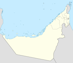
Jumeirah Archaeological Site
This article has an unclear citation style. (January 2020) |
 The archaeological site | |
| Location | Dubai, the U.A.E. |
|---|---|
| Coordinates | 25°11′48″N 55°14′30″E / 25.19679°N 55.24180°E |
| Area | Approximately 80,000 m2 (8.0 ha; 20 acres)[1] |
| Site notes | |
| Discovered | 1969[1] |
The Jumeirah Archaeological Site is a site which dates back to the
Dubai Culture & Arts Authority
.
Overview
Archaeological excavations at the site,[1][2][3] which was discovered in 1969, demonstrate that the area was inhabited as far back as the Abbasid era, approximately in the 10th century CE. At this time, it appears to have been the coastal part of an Eastern Arabian subregion referred to as 'Tawam', which comprises the city of Al Ain in the Emirate of Abu Dhabi, and the adjacent Omani town of Al-Buraimi.[4][5] Measuring about 80,000 m2 (860,000 sq ft), the site lays along a caravan route linking India and China to Oman and Iraq.[1][2][3]
See also
- Archaeology of the United Arab Emirates
- Dubai Museum
- History of the United Arab Emirates
- List of Ancient Settlements in the UAE
References
- ^ a b c d e Al Amir, Khitam; Cherian, Dona (2020-01-09). "Look: Sheikh Mohammed Bin Rashid visits Jumeirah Archaeological Site". Gulf News. Retrieved 2020-01-12.
- ^ a b c "Mohammed bin Rashid visits Jumeirah Archaeological Site". Emirates 24/7. 2020-01-09. Retrieved 2020-01-12.
- ^ a b c "'Happy and proud' Ruler of Dubai meets archaeologists at Jumeirah dig site". The National. 2020-01-09. Retrieved 2020-01-12.
- ISBN 978-1-900724-47-0.
- ^ Leech, Nick (2015-10-22). "The long read: has a lost Arab capital been found on the Oman-UAE border?". The National. Retrieved 2019-01-20.
External links
- Jumeirah Archaeological Site, Dubai Culture & Arts Authority
- Lonelyplanet website


