
Kfar Yehezkel
Kfar Yehezkel
כְּפַר יְחֶזְקֵאל | |
|---|---|
 Kfar Yehezkel seen from a hot air balloon. | |
| Etymology: Yehezkel Village | |
 Kfar Yehezkel | |
| Coordinates: 32°34′2″N 35°21′32″E / 32.56722°N 35.35889°E | |
| Country | Israel |
| District | Northern |
| Council | Gilboa |
| Affiliation | Moshavim Movement |
| Founded | 16 December 1921 |
| Founded by | Second Aliyah pioneers |
| Population (2022)[1] | 1,242 |
Kfar Yehezkel (
History
Kfar Yehezkel was founded on 16 December 1921 by pioneers of the Second Aliyah.[2] Settlers from Tel Hai and Hamara, which was evacuated because of Arab attacks from Lebanon, were also among the founding members. It was the second moshav ovdim in Palestine, after Nahalal.[3]
Originally called Ayn Tib'un after the nearby spring, the early development of the moshav was funded by the partners of E & J S Sykes, a firm of international cotton, tea & opium merchants based in
The driver of the moshav was injured in 1936 during a spate of Arab violence.[4]
-
 Kfar Yehezkel 1926
 -
 Deep ploughing in Kfar Yehezkel, 1925–1937
 -
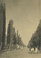 The entrance to Kfar Yehezkel, 1925–1937
 -
 Kfar Yehezkel, 1937–1938
 -
 Kfar Yehezkel 1937
 -
 Kfar Yehezkel 1939
 -
 Kfar Yehezkel 1945

.jpg)
.jpg)


Architectural master plan
Kfar Yehezkel's general layout was designed by Richard Kauffmann at about the same time as he drew the plans for the better-known Nahalal settlement. Similarly, it grouped the public buildings at the centre with several residential buildings surrounding them along an inner ring road, with individual plots of agricultural land radiating outwards between straight roads, and additional housing along these roads. The geometrical symmetry of the initial settlement was less stringent than was the case with Nahalal, also due to the semicircular shape of the plateau at the centre of the village.[5]
Notable residents
- Igal Talmi (born 1925), nuclear physicist
- Uzi Feinerman (1924–1975), politician, Member of the Knesset
References
- ^ a b "Regional Statistics". Israel Central Bureau of Statistics. Retrieved 21 March 2024.
- ^ Family Affair: The Broidas, Kfar Yehezkel Haaretz, 16 April 2009
- ^ The Industrial Geography of Israel
- ^ The Letters of Martin Buber
- ^ Richard Kauffmann, Die Bebauungsplaene der Kleinsiedlungen Kfar-Nahalal und Kfar-Jecheskiel ('The construction plans for the agricultural small housing estates Kfar Nahalal and Kfar Yehezkel|Kfar Jecheskiel'), published by the Department for Agricultural Colonization of the Zionist Executive, Jerusalem (1923), in German.
Further reading
- HaReuveni, Immanuel (1999). Lexicon of the Land of Israel (in Hebrew). Miskal – Yedioth Ahronoth Books and Chemed Books. p. 505. ISBN 965-448-413-7.
- Yuval Elezri (ed) – Lexicon Mapa – Eretz Israel – Map's Concise Gazetteer of Israel Today 2003 Tel Aviv MAP Mapping and Publishing (in Hebrew)
- On Sabbath Eve Satan Came to Kfar Yehezkel: The Conflict over the Establishment of a Synagogue in a Socialist Village
| International | |
|---|---|
| National | |