
La Junta Gardens, Colorado
La Junta Gardens, Colorado | |
|---|---|
MDT) | |
| ZIP Code[3] | La Junta 81050 |
| Area codes | 970 |
| GNIS feature[2] | La Junta Gardens CDP |
La Junta Gardens is a
Zip Code 81050) serves the area.[3]
Geography
The La Junta Gardens CDP has an area of 341 acres (1.381 km2), all land.[1]
Demographics
| Year | Pop. | ±% |
|---|---|---|
| 2010 | 153 | — |
| 2020 | 123 | −19.6% |
| Source: United States Census Bureau | ||
The
United States Census 2010
.
See also
References
- ^ a b c d e "State of Colorado Census Designated Places - BAS20 - Data as of January 1, 2020". United States Census Bureau. Retrieved December 26, 2020.
- ^ a b c "U.S. Board on Geographic Names: Domestic Names". United States Geological Survey. Retrieved December 26, 2020.
- ^ a b "Zip Code 81050 Map and Profile". zipdatamaps.com. 2020. Retrieved December 26, 2020.
External links
Wikimedia Commons has media related to La Junta Gardens, Colorado.
- La Junta @ Colorado.com
- La Junta @ UncoverColorado.com
- La Junta Tourism
- La Junta Rural Fire Protection District
- Otero County website
Municipalities and communities of Otero County, Colorado, United States | ||
|---|---|---|
| Cities | 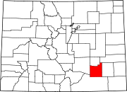 | |
| Towns | ||
| CDPs | ||
| Unincorporated communities | ||
| Ghost town | ||
| Trading posts |
| |
| ||