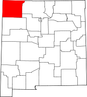
Lee Acres, New Mexico
Lee Acres, New Mexico | |
|---|---|
Census-designated place | |
UTC-6 (MDT) | |
| GNIS feature ID | 2584139[3] |
Lee Acres is a
.Demographics
| Census | Pop. | Note | %± |
|---|---|---|---|
| 2020 | 4,170 | — | |
| U.S. Decennial Census[5][2] | |||
Education
Most of Lee Acres is in Farmington Municipal Schools while a portion is in Bloomfield Schools.[6] Bloomfield High School is the local high school of the latter.
References
- ^ "ArcGIS REST Services Directory". United States Census Bureau. Retrieved October 12, 2022.
- ^ a b "Census Population API". United States Census Bureau. Retrieved October 12, 2022.
- ^ "Lee Acres". Geographic Names Information System. United States Geological Survey, United States Department of the Interior.
- ^ "U.S. Census website". United States Census Bureau. Retrieved December 7, 2014.
- ^ "Census of Population and Housing". Census.gov. Retrieved June 4, 2016.
- U.S. Census Bureau. Retrieved July 12, 2022.

