
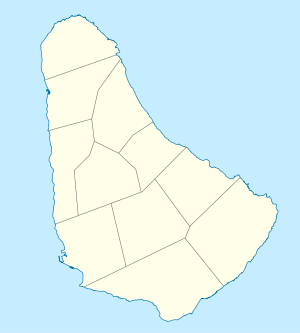
List of cities, towns and villages in Barbados

This is a list of the Americas. It is 34 kilometres (21 miles) in length and up to 23 km (14 mi) in width, covering an area of 432 km2 (167 sq mi). It is situated in the western area of the North Atlantic and 100 km (62 mi) east of the Windward Islands and the Caribbean Sea;[1] Many of the village names in Barbados are based upon the names of plantations.[2] Barbados is divided into 11 parishes.
Christ Church
- Atlantic Shores
- Bannatyne
- Blue Waters
- Boarded Hall
- Briggs
- Callenders
- Cane Vale
- Chancery Lane
- Charnocks
- Clapham
- Edey
- Hastings
- Hopewell
- Maxwell
- Maxwell Hill
- Newton Terrace
- Oistins
- Rockley
- Scarborough
- Seawell
- Saint Lawrence
- Welches
- Woman's Bay
- Worthing
- Wotton
- Yorkshire
Saint Andrew
Cherry Tree Hill
- Barclays Park
- Baxters
- Belleplaine
- Breedy's
- Bruce Vale
- Chalky Mount
- Cherry Tree Hill
- Greenland
- Hillaby
- Turner's Hall Woods – park and nature reserve
- White Hill
Saint George
Saint James

Saint John
- Bath
- Bowmanston
- Cherry Grove
- Coach Hill
- Gall Hill
- Glebe Land
- Hohtersal
- Kendal
- Mount Tabor
- Saint Marks
- Saint Margaret's)
- Sherbourne
- Venture
- Messiah Street
Saint Joseph
Bathsheba
- Airy Hill
- Bathsheba
- Bissex
- Blackmans
- Bonwell
- Branchbury
- Buckden House
- Cambridge
- Canefield
- Castle Grant
- Cattlewash
- Chimborazo
- Hackleton's Cliff
- Horse Hill
- Sugar Hill
Saint Lucy
Saint Michael
Bridgetown, Capital of Barbados

- Bank Hall
- Gay
- Belfield
- Belle
- Bibbys Lane
- Black Rock
- Bridgetown(110,000) – the capital of Barbados
- Brighton
- Brittons Hill
- Bush Hall
- Canewood
- Carrington
- Cave Hill
- Clermont
- Codrington
- Dayrells
- Deacons
- Deacons Farm
- Eagle Hall
- Eden Lodge
- Fairfield
- Fontabelle
- Friendship
- Friendship Terrace
- Goodland
- Grazettes
- Green Hill
- Haggatt Hall
- Harmony Hall
- Henrys
- Highgate
- Hothersal Turning
- Howells
- Ivy
- Jackmans
- Kew
- Lazarette
- Lodge Hill
- Lower Estate
- Mapp Hill
- Neils
- Pine Hill
- Prospect
- Rock Dundo
- Rouen
- Spring Garden
- Station Hill
- St Barnabas
- Two Mile Hill
- Upton
- Wanstead
- Warrens
- Waterford
- Whitehall
- Wildey
Saint Peter
- Alleynedale
- Ashburton Grove, The Castle
- Ashton Hall
- Bakers
- Battleys
- Black Bess
- Boscobelle
- The Castle
- Diamond Corner
- Farley Hill
- Fourhill
- French Village
- Gibbes
- Haymans
- Indian Ground
- Mile and a Quarter
- Mangrove Terrace
- Mullins Terrace
- Portland
- Road View
- Rock Hall
- Rose Hill
- Six Mens
- Speightstown (3,600) – the second-largest town centre of Barbados
- Sunbury
- The Whim
-

-
 A Mini Moke on the beach at Speightstown, Barbados


Saint Philip
Ragged Point
- Bayfield
- Bayleys
- Bel Air
- Bentleys
- Blades
- Blades Hill
- Brereton
- Bushy Park
- Carrington
- Caveland
- Church Village
- Foul Bay
- Four Roads
- Kirtons
- Mangrove
- Marchfield
- Ragged Point
- Saint Martins
- Six Cross Roads
- Sunbury
- The Crane
- Three Houses
- Woodbourne
- Workhall
- Rices
- Rock Hall
- Gemswick
- Harlington
- Heddings
- Foul Bay
Saint Thomas
Unsorted
See also
 Lists portal
- Parishes of Barbados
- List of schools in Barbados
- List of cities by country
- List of towns
References
- ^ Chapter 4 – The Windward Islands and Barbados – U.S. Library of Congress
- ISBN 9780887292828. Retrieved 21 June 2016.
- ^ "United States Congressional Serial Set". U.S. Government Printing Office. 1965. p. 375. Retrieved 21 June 2016.
- ISBN 978-976-8125-74-3. Retrieved June 21, 2016.
- ISBN 978-976-637-148-7. Retrieved June 21, 2016.
- ISBN 978-1-909268-32-6. Retrieved June 21, 2016.
- ISBN 978-0-8063-1004-6. Retrieved June 21, 2016.
- ISBN 978-0-307-92803-0. Retrieved June 21, 2016.
External links
Wikimedia Commons has media related to Populated places in Barbados.