
Lower Connecticut River Valley Planning Region, Connecticut
Lower Connecticut River Valley Planning Region | |
|---|---|
Planning region | |
| Lower Connecticut River Valley Council of Governments (RiverCOG) | |
_AM_1504_Vibrant.jpg) .jpg)    From top left: Gillette Castle State Park, Connecticut River Museum, Essex Village, North Cove in Old Saybrook, Main Street Historic District in Middletown | |
|
UTC−4 (EDT) | |
| Congressional districts | 1st, 2nd, 3rd |
| Website | rivercog |

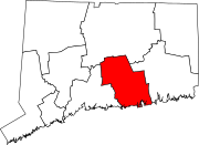
Interactive map of the Lower Connecticut River Valley Planning Region
The Lower Connecticut River Valley Planning Region is a
county-equivalent in Connecticut. It is served by the coterminous Lower Connecticut River Valley Council of Governments (RiverCOG). In 2022, planning regions were approved to replace Connecticut's counties as county-equivalents for statistical purposes, with full implementation occurring by 2024.[1][2]
Demographics
| Census | Pop. | Note | %± |
|---|---|---|---|
| 2020 | 174,225 | — | |
| 2022 (est.) | 176,622 | [3] | 1.4% |
| U.S. Decennial Census[2] | |||
As of the 2020 United States census, there were 174,225 people living in the Lower Connecticut River Valley Planning Region.[2]
Municipalities
The following municipalities are members of the Lower Connecticut River Valley Region:[4]
City
Towns
- Chester
- Clinton
- Cromwell
- Deep River
- Durham
- East Haddam
- East Hampton
- Essex
- Haddam
- Killingworth
- Lyme
- Middlefield
- Old Lyme
- Old Saybrook
- Portland
- Westbrook
References
- ^ "Governor Lamont Announces U.S. Census Bureau Approves Proposal for Connecticut's Planning Regions To Become County Equivalents". CT.gov. Retrieved March 24, 2023.
- ^ a b c "Change to County-Equivalents in the State of Connecticut". Federal Register. June 6, 2022. Retrieved March 24, 2023.
- ^ "U.S. Census Bureau QuickFacts: Lower Connecticut River Valley Planning Region, Connecticut; United States". www.census.gov. Retrieved May 13, 2023.
- ^ "Lower Connecticut River Valley Council of Governments". Retrieved March 24, 2023.
External links
Wikimedia Commons has media related to Lower Connecticut River Valley Planning Region, Connecticut.
 | ||||
Towns | ||||
| ||||