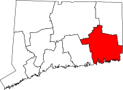
Bozrah, Connecticut
Bozrah, Connecticut | ||
|---|---|---|
| Town of Bozrah | ||
 Town Hall | ||
|
FIPS code 09-06820 | | |
| GNIS feature ID | 0213394 | |
| Website | www | |
Bozrah is a
History
The area that became Bozrah was first settled as part of the original "nine-miles-square" of Norwich as well as part of the Parish of West Farms. The area became its own parish, called "New Concord" or the "Fourth Society of Norwich", in 1737, and was incorporated as the town of Bozrah in 1786.
A legend about the origin of the town's name
According to a persistent legend, the name "Bozrah" was derived from another Biblical text, which came to someone's mind under the particular circumstances surrounding the community's petition to the Connecticut General Assembly for township status. Whether or not the story is true, the informal, early name "New Concord" was dropped when the town was incorporated.[2]
The community, according to the legend, really wanted to call itself "Bath" after the famous spa in England. The local man chosen to carry the parish's request to Hartford had a somewhat eccentric manner of dress, however, and when he appeared before the Legislature he was dressed in loud, parti-colored homespun so odd as to bring to the mind of one amused legislator the query of Isaiah 63:1: "Who is this that cometh from Edom, with dyed garments from Bozrah?" Overcome by the humorous appropriateness of this verse, the Assembly decided to name the town "Bozrah" when it incorporated the place.[2]
Points of interest
- Bozrah Congregational Church and Parsonage, at 17 and 23 Bozrah St., was added to the National Register of Historic Places on August 26, 1991.
- Hopemead State Park, an undeveloped 60-acre recreation area.
Geography
According to the United States Census Bureau, the town has a total area of 20.2 square miles (52.4 km2), of which 20.0 square miles (51.7 km2) is land and 0.27 square miles (0.7 km2), or 1.38%, is water. The town is bordered by the city of Norwich to the east and by the town of Montville to the south, Salem to the southwest, Colchester to the west, Lebanon to the northwest, and Franklin to the north. 529-acre (2.14 km2) Gardner Lake, a popular recreational destination, occupies the southwestern corner of the town and extends into Salem and Montville.
Demographics
| Census | Pop. | Note | %± |
|---|---|---|---|
| 1820 | 1,085 | — | |
| 1830 | 1,079 | −0.6% | |
| 1840 | 1,067 | −1.1% | |
| 1850 | 867 | −18.7% | |
| 1860 | 1,216 | 40.3% | |
| 1870 | 984 | −19.1% | |
| 1880 | 1,155 | 17.4% | |
| 1890 | 1,005 | −13.0% | |
| 1900 | 799 | −20.5% | |
| 1910 | 861 | 7.8% | |
| 1920 | 858 | −0.3% | |
| 1930 | 859 | 0.1% | |
| 1940 | 904 | 5.2% | |
| 1950 | 1,154 | 27.7% | |
| 1960 | 1,590 | 37.8% | |
| 1970 | 2,036 | 28.1% | |
| 1980 | 2,135 | 4.9% | |
| 1990 | 2,297 | 7.6% | |
| 2000 | 2,357 | 2.6% | |
| 2010 | 2,627 | 11.5% | |
| 2020 | 2,429 | −7.5% | |
| U.S. Decennial Census[4] | |||
As of the
There were 883 households, out of which 32.6% had children under the age of 18 living with them, 62.6% were married couples living together, 7.4% had a female householder with no husband present, and 25.0% were non-families. 19.6% of all households were made up of individuals, and 6.3% had someone living alone who was 65 years of age or older. The average household size was 2.64 and the average family size was 3.03.
In the town, the population was spread out, with 23.5% under the age of 18, 5.9% from 18 to 24, 30.1% from 25 to 44, 26.5% from 45 to 64, and 14.0% who were 65 years of age or older. The median age was 40 years. For every 100 females, there were 100.8 males. For every 100 females age 18 and over, there were 101.6 males.
The median income for a household in the town was $57,059, and the median income for a family was $65,481. Males had a median income of $45,291 versus $27,361 for females. The
As of 2015, the median household income in Bozrah was estimated to be $77,045, compared to $70,331 for the State of Connecticut as a whole. The low income rate, defined as all persons whose annual household income is less than 200 percent of the poverty threshold, was 22%, compared to 30% statewide.[6]
| Voter Registration and Party Enrollment as of October 29, 2019[7] | |||||
|---|---|---|---|---|---|
| Party | Active Voters | Inactive Voters | Total Voters | Percentage | |
| Democratic | 608 | 24 | 632 | 33.02% | |
| Republican | 403 | 11 | 414 | 21.63% | |
| Unaffiliated | 783 | 34 | 817 | 42.69% | |
Minor Parties
|
49 | 2 | 51 | 2.66% | |
| Total | 1,843 | 71 | 1,914 | 100% | |
| Presidential Election Results[8][9] | |||
|---|---|---|---|
| Year | Democratic | Republican | Third Parties
|
| 2020 | 45.4% 703 | 52.8% 817 | 1.8% 28 |
| 2016 | 38.6% 536 | 55.0% 764 | 6.4% 89 |
| 2012 | 50.4% 648 | 47.0% 606 | 2.6% 34 |
| 2008 | 52.1% 723 | 45.6% 633 | 2.3% 32 |
| 2004 | 51.4% 723 | 45.9% 646 | 2.7% 38 |
| 2000 | 51.5% 687 | 41.9% 561 | 6.6% 89 |
| 1996 | 47.3% 574 | 32.7% 398 | 20.0% 243 |
| 1992 | 35.9% 471 | 30.7% 404 | 33.4% 439 |
| 1988 | 42.1% 479 | 56.1% 639 | 1.8% 21 |
| 1984 | 34.2% 387 | 65.7% 745 | 0.1% 2 |
| 1980 | 38.4% 414 | 50.0% 540 | 11.6% 126 |
| 1976 | 47.3% 452 | 52.4% 502 | 0.3% 3 |
| 1972 | 35.5% 331 | 63.9% 599 | 0.6% 6 |
| 1968 | 46.6% 398 | 47.7% 408 | 5.7% 49 |
| 1964 | 66.3% 549 | 33.7% 279 | 0.00% 0 |
| 1960 | 47.0% 367 | 53.0% 415 | 0.00% 0 |
| 1956 | 41.2% 393 | 58.8% 668 | 0.00% 0 |
Education
The town's educational center, Fields Memorial School, serves grades Preschool to 8, and is located in Fitchville. While there is no high school in Bozrah, the town pays tuition for students attending Norwich Free Academy or Lyman Memorial; the state pays for students' tuition at Norwich Technical High School and Waterford High School.[10]
Notable people
- Sam Gejdenson (born 1948), former United States congressman
- Alanson Hodges Hough (1803–1886), physician and politician
- Congregationalistminister
- Ishmail Spicer (1760–1832), composer, publisher and teacher
- Reuben Hyde Walworth (1788–1867), United States congressman, was nominated three times to become Justice of the United States Supreme Court
References
- ^ "Census - Geography Profile: Bozrah town, New London County, Connecticut". Retrieved November 26, 2021.
- ^ ISBN 1-880684-05-5Web page accessed July 23, 2006
- ^ The Connecticut Magazine: An Illustrated Monthly. Connecticut Magazine Company. 1903. p. 331.
- ^ "Census of Population and Housing". Census.gov. Retrieved June 4, 2015.
- ^ "U.S. Census website". United States Census Bureau. Retrieved January 31, 2008.
- ^ "Bozrah Town Profile". Retrieved June 30, 2017.
- ^ "Registration and Party Enrollment Statistics as of October 29, 2019" (PDF). Connecticut Secretary of State. Retrieved February 17, 2020.
- ^ "General Election Statements of Vote, 1922 – Current". CT Secretary of State. Retrieved July 11, 2020.
- ^ "Election Night Reporting". CT Secretary of State. Retrieved December 16, 2020.
- ^ Town of Bozrah Board of Education. "Our Schools". Retrieved January 12, 2022.
External links
 | ||||
Towns | ||||
Boroughs | ||||
| CDPs |
| |||
Other communities | ||||
| Indian reservations | ||||
| Footnotes | ‡This populated place also has portions in an adjacent county or counties | |||
| ||||