
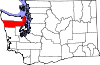
Marrowstone, Washington
Marrowstone, Washington | ||
|---|---|---|
FIPS code 53-43762[2] | | |
| GNIS feature ID | 1852949[3] | |
Marrowstone is a
Marrowstone takes its name from Marrowstone Point, the northernmost point on Marrowstone Island. It was given the name "Marrow-Stone Point" in 1792 by the British explorer, George Vancouver, in describing the area's hard, clay-like soil.[4]
History
A post office called Nordland has been in operation since 1898.[5] The community derives its name from Peter Nordby, the original owner of the town site.[6]
Geography


According to the United States Census Bureau, the CDP has a total area of 6.3 square miles (16.4 km2), all of it land.
Prominent land features include several points, such as Marrowstone Point, at the northern end of Marrowstone Island, Kinney Point, at the southern end of the island, Nodule Point, on the east side, mid island, and Griffiths Point, on the western side of Mystery Bay, which is an inlet on the western side of Marrowstone Island. Other notable features include East Beach, a sandy beach at the northern end of East Marrowstone Road and Scow Bay/Kilisut Harbor, which separates Marrowstone Island from its western neighbor, Indian Island, a Navy ammunition depot.
A narrow causeway connects the southwestern end of Marrowstone Island with the southern end of Indian Island. A short bridge joins the western side of Indian Island to the mainland of Jefferson County.
Flagler Road (SR 116) runs along the western edge of Marrowstone Island, which is primarily low-lying. East Marrowstone Road runs along the eastern edge of the island, which consists largely of sandy bluffs, with the exception of the area near East Beach.
Demographics
As of the
There were 432 households, out of which 10.4% had children under the age of 18 living with them, 55.1% were married couples living together, 3.7% had a female householder with no husband present, and 39.8% were non-families. 30.3% of all households were made up of individuals, and 16.0% had someone living alone who was 65 years of age or older. The average household size was 1.95 and the average family size was 2.37.
In the CDP, the population skewed older with 90.5% 18 and over, 46.3% over 62, and 36.1% who were 65 years of age or older. The median age was 60.5 years. For every 100 males there were 98.1 females.
The median income for a household in the CDP was $48,533, and the median income for a family was $54,397. Males had a median income of $45,000 versus $26,607 for females. The
Arts and culture
The Nordland General Store is Marrowstone's only source of
Festivals and events
For approximately 100 years, Marrowstone has held its annual Strawberry Festival in June. Residents and visitors enjoy strawberry shortcake at the Nordland Garden Club Building. The Marrowstone Island Community Association hosts the Strawberry Festival each year. It meets about 7 times throughout the year at the Nordland Garden Club Building. Strawberries were once grown all over Marrowstone and can be found growing wild on the island.
On Memorial Day weekend, island residents bring their tractors to parade them in front of the Nordland General Store.
The
The
Parks and recreation
References
- ^ "US Gazetteer files: 2010, 2000, and 1990". United States Census Bureau. February 12, 2011. Retrieved April 23, 2011.
- ^ a b "U.S. Census website". United States Census Bureau. Retrieved January 31, 2008.
- ^ "Marrowstone". Geographic Names Information System. United States Geological Survey, United States Department of the Interior.
- ISBN 978-1-4120-7097-3.
- ^ "Post Offices". Jim Forte Postal History. Retrieved August 19, 2016.
- ^ Meany, Edmond S. (1923). Origin of Washington geographic names. Seattle: University of Washington Press. p. 191.
- ^ "UPDATE: Nordland General Store facing an uncertain future".
External links
 | ||||
| CDPs | ||||
| Other communities | ||||
| Indian reservation |
| |||
| Ghost towns |
| |||
| Footnotes | ‡This populated place also has portions in an adjacent county or counties | |||