
Miyazu, Kyoto
Miyazu
宮津市 | |
|---|---|
 | |
|
Pinus |
Miyazu (宮津市, Miyazu-shi) is a city located in Kyoto Prefecture, Japan. As of 28 February 2022[update], the city had an estimated population of 16,988 in 8348 households and a population density of 98 persons per km2.[1] The total area of the city is 172.74 square kilometres (66.70 sq mi).
Geography
Miyazu is located in the northern part of Kyoto Prefecture at the base of the
Neighboring municipalities
Kyoto Prefecture
- Kyōtango
- Maizuru
- Fukuchiyama
- Yosano
- Ine
Climate
Miyazu has a humid subtropical climate (Köppen Cfa), featuring a marked seasonal variation in temperature and precipitation. Summers are hot and humid, but winters are relatively cold with occasional snowfall. The average annual temperature in Miyazu is 14.8 °C (58.6 °F).[2] The average annual rainfall is 1,917.8 mm (75.50 in) with September as the wettest month. The temperatures are highest on average in August, at around 26.8 °C (80.2 °F), and lowest in January, at around 4.1 °C (39.4 °F).[3] Its record high is 38.8 °C (101.8 °F), reached on 22 August 2018, and its record low is −7.7 °C (18.1 °F), reached on 12 February 1984.[4]
| Climate data for Miyazu (1991−2020 normals, extremes 1978−present) | |||||||||||||
|---|---|---|---|---|---|---|---|---|---|---|---|---|---|
| Month | Jan | Feb | Mar | Apr | May | Jun | Jul | Aug | Sep | Oct | Nov | Dec | Year |
| Record high °C (°F) | 18.3 (64.9) |
22.7 (72.9) |
24.4 (75.9) |
30.5 (86.9) |
33.1 (91.6) |
35.7 (96.3) |
37.8 (100.0) |
38.8 (101.8) |
36.9 (98.4) |
32.1 (89.8) |
26.0 (78.8) |
22.4 (72.3) |
38.8 (101.8) |
| Mean daily maximum °C (°F) | 7.9 (46.2) |
8.6 (47.5) |
12.4 (54.3) |
17.9 (64.2) |
22.8 (73.0) |
25.9 (78.6) |
30.2 (86.4) |
31.9 (89.4) |
27.5 (81.5) |
22.2 (72.0) |
16.6 (61.9) |
10.8 (51.4) |
19.6 (67.2) |
| Daily mean °C (°F) | 4.1 (39.4) |
4.3 (39.7) |
7.4 (45.3) |
12.5 (54.5) |
17.4 (63.3) |
21.2 (70.2) |
25.5 (77.9) |
26.8 (80.2) |
22.7 (72.9) |
17.1 (62.8) |
11.8 (53.2) |
6.6 (43.9) |
14.8 (58.6) |
| Mean daily minimum °C (°F) | 0.9 (33.6) |
0.6 (33.1) |
2.7 (36.9) |
7.2 (45.0) |
12.4 (54.3) |
17.3 (63.1) |
22.0 (71.6) |
22.9 (73.2) |
19.0 (66.2) |
13.1 (55.6) |
7.7 (45.9) |
3.1 (37.6) |
10.7 (51.3) |
| Record low °C (°F) | −5.8 (21.6) |
−7.7 (18.1) |
−5.2 (22.6) |
−1.9 (28.6) |
3.5 (38.3) |
7.0 (44.6) |
13.6 (56.5) |
15.2 (59.4) |
8.8 (47.8) |
2.0 (35.6) |
−1.7 (28.9) |
−4.2 (24.4) |
−7.7 (18.1) |
| Average precipitation mm (inches) | 202.9 (7.99) |
150.4 (5.92) |
136.4 (5.37) |
111.9 (4.41) |
132.8 (5.23) |
146.1 (5.75) |
199.9 (7.87) |
142.1 (5.59) |
226.9 (8.93) |
156.1 (6.15) |
124.0 (4.88) |
188.5 (7.42) |
1,917.8 (75.50) |
| Average precipitation days (≥ 1.0 mm) | 20.9 | 16.9 | 15.2 | 11.7 | 10.3 | 11.3 | 12.2 | 9.2 | 11.9 | 11.5 | 14.3 | 18.9 | 164.3 |
| Mean monthly sunshine hours | 70.6 | 84.3 | 132.5 | 180.6 | 194.5 | 142.6 | 156.0 | 200.9 | 136.7 | 137.6 | 106.4 | 81.9 | 1,621.9 |
| Source: Japan Meteorological Agency[4][3] | |||||||||||||
Demographics
Per Japanese census data,[5] the population of Miyazu in 2020 is 16,758 people. Miyazu has been conducting censuses since 1920. The city's population peaked in 1945 and has declined gradually in the decades since. It is now less than half what it was post-World War II.
Graphs are unavailable due to technical issues. There is more info on Phabricator and on MediaWiki.org. |
| Year | Pop. | ±% |
|---|---|---|
| 1920 | 27,264 | — |
| 1925 | 29,248 | +7.3% |
| 1930 | 30,320 | +3.7% |
| 1935 | 31,628 | +4.3% |
| 1940 | 30,639 | −3.1% |
| 1945 | 36,330 | +18.6% |
| 1950 | 36,225 | −0.3% |
| 1955 | 36,200 | −0.1% |
| 1960 | 34,799 | −3.9% |
| 1965 | 33,285 | −4.4% |
| 1970 | 31,603 | −5.1% |
| 1975 | 30,194 | −4.5% |
| 1980 | 28,881 | −4.3% |
| 1985 | 27,895 | −3.4% |
| 1990 | 26,450 | −5.2% |
| 1995 | 24,937 | −5.7% |
| 2000 | 23,276 | −6.7% |
| 2005 | 21,512 | −7.6% |
| 2010 | 19,948 | −7.3% |
| 2015 | 18,426 | −7.6% |
| 2020 | 16,758 | −9.1% |
| Miyazu population statistics[5] | ||
History
The area of present-day Miyazu was part of ancient
Government
.jpg)
Miyazu has a
Economy
Miyazu has an economy based on agriculture, regional commerce, and seasonal tourism.
Education
Miyazu has six public elementary schools and three public middle schools operated by the town government and two public high schools operated by the Kyoto Prefectural Department of Education. There is also one private high school.
Transportation

Railways
![]() Kyoto Tango Railway – Miyazu Line
Kyoto Tango Railway – Miyazu Line
- Iwatakiguchi - Amanohashidate - Miyazu - Kunda - Tango-Yura
![]() Kyoto Tango Railway – Miyafuku Line
Kyoto Tango Railway – Miyafuku Line
Highways
 Kyoto Jūkan Expressway: (Maizuru)- Miyazu-Amanohashidate IC
- San'in Kinki Expressway: Yoza-Amanohashidate IC - (Yosano)
 National Route 176
 National Route 178
Seaport
- Port of Miyazu

International relations
Twin towns – sister cities
| Country | City | State / Region | Since |
|---|---|---|---|
| 1976 | |||
| Delray Beach | 1977 |
Local attractions
- Ama-no-Hashidate (one of the Three Views of Japan)
- Catholic Miyazu Church
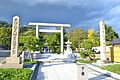
- Kono Shrine (Ichinomiya of Tango Province)
- Seikiro Ryokan (Japan Heritage・No43.Tango Chirimen Textile Road)
- Tango Kokubun-ji, National Historic Site
-

-
 Catholic Miyazu Church
 -
-
 Seikiro Ryokan
 -

-
 ResortMansion of Hioki Area


_otorii.JPG)
.jpg)

.jpg)
Festival&Events

- Miyazu matsuri
References
- ^ "Miyazu city official statistics" (in Japanese). Japan.
- ^ Miyazu climate data
- ^ a b 気象庁 / 平年値(年・月ごとの値). JMA. Retrieved March 28, 2022.
- ^ a b 観測史上1~10位の値(年間を通じての値). JMA. Retrieved March 28, 2022.
- ^ a b Miyazu population statistics
- ^ US Department of State. (1906). A digest of international law as embodied in diplomatic discussions, treaties and other international agreements (John Bassett Moore, ed.), Vol. 5, p. 759.
External links
- Miyazu City official website in Japanese
- Japan guide information on Amanohashidate in English
| International | |
|---|---|
| National | |
| Geographic | |
This Kyoto Prefecture location article is a stub. You can help Wikipedia by expanding it. |