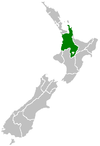
Mokai Power Station
Appearance
| Mokai Power Station | ||
|---|---|---|
 | ||
| Country | New Zealand | |
| Location | Annual net output 930 GWh[1] | |
| External links | ||
| Website | www.tuaropaki.com | |
| ] | ||
The Mokai Power Station is a
Ormat Industries
.
The Tuaropaki Power Company is 75% owned by the Tuaropaki Trust and 25% by Mighty River Power.[2]
The plant was initially constructed in 1999 as a 55 MW geothermal power station. An additional 40 MW was added in 2005 and in 2007 plant capacity was increased to 110 MW.[3]

See also
References
- ^ "Mokai". NZ Geothermal Association. Archived from the original on 2 June 2010. Retrieved 7 December 2013.
- ^ "Our Power Stations". Mighty River Power.
- ^ "Mokai geothermal system". Waikato Regional Council.

