
Mount Derak
This article has multiple issues. Please help improve it or discuss these issues on the talk page. (Learn how and when to remove these template messages)
|

| Mount Derock | |
|---|---|
 View of Drak Mountain located in Shiraz, Iran | |
| Highest point | |
| Elevation | 9,514 ft (2,900 m) |
| Prominence | 4,605 ft (1,404 m) |
| Coordinates | 29°41′02″N 52°24′14″E / 29.684°N 52.404°E |
| Geography | |
| Location | Shiraz, Iran |
| Parent range | Zagros Mountains |
| Topo map | Mount Derak |
| Geology | |
| Age of rock | < 40,000 yrs |
| Mountain type | Sedimentary rock |
| Climbing | |
| First ascent | 1841 |
| Easiest route | Hike via south western zone |
Mount Derock or Deraak (also known as Kuh-eh Barfee
Geologically, Shiraz is a syncline valley city (NW–SE elongated) that formed between the Baba Kohi and Derak anticlines.[4]
-
 Mount Derak view from Shiraz in winter
 -
 Snow Mount Derak
 -
 Mount Derak view from Shiraz in winter
 -
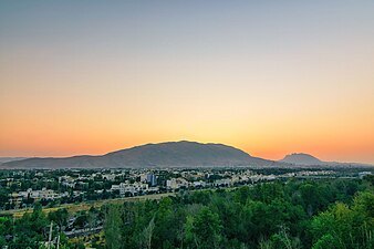
 Sunset in Shiraz viewing north-west – Kowsar hospital is visible in the bottom right
 -
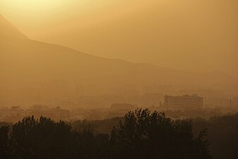
 Golden hour in Shiraz viewing Mt. Derak


References
- S2CID 85095226.
- ^ Mobaraki, Abdollah (2012). Strategies for Mitigating Urban Heat Island Effects in Cities: Case of Shiraz City Center (PDF) (Thesis). Eastern Mediterranean University.
- ^ Foundation, Encyclopaedia Iranica. "Welcome to Encyclopaedia Iranica". iranicaonline.org. Retrieved 2021-05-04.
- ISSN 1674-9871.