Munchique National Natural Park
| Parque Nacional Natural Munchique | |
|---|---|
| Munchique National Natural Park | |
 | |
| Nearest city | El Tambo, Cauca, Colombia |
| Coordinates | 2°42′N 77°5′W / 2.700°N 77.083°W |
| Area | 440 km2 (170 sq mi) |
| Established | May 1977[1] |
| Governing body | SINAP |
The Munchique National Natural Park (
General
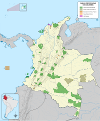
It is located in
.It was declared a national park in May 1977 and covers and area of 440 km2 (170 sq mi). The park takes its name from the Munchique Mountain, located in the southeast part of the area.[3][4] Many of the rivers in the area are tributaries to the San Juan de Micay River, one of the largest rivers in the Colombian Pacific Basin, that eventually reaches the Pacific Ocean.[4] It is currently in danger due to illegal crops and other ecological threats.[4]
Climate

There are several climate levels in the area, shifting with elevation: warm, 200 m (660 ft)–1,000 m (3,300 ft)
Flora and fauna
In the warm and temperate zones it is possible to find trees reaching above 40 m (130 ft).[3] The number of trees diminishes as elevation increases and epiphytes becomes more common.[5]
The park has one of Colombia's highest biodiversity indices and a high number of endemic and endangered species, this due to low human activity in the area and diversity of thermal levels.
Footnotes
- ^ IUCN 1982, p. 141
- ^ a b "Parque Nacional Natural de Munchique" (in Spanish). Parques Nacionales Naturales de Colombia. Retrieved 10 July 2010.
- ^ a b c d "Munchique, Tesoro Selvático Del Cauca". El Tiempo. 29 August 1997. Retrieved 11 July 2010.
- ^ a b c Villegas & Sesana 2007, p. 143
- ^ a b c d Villegas & Sesana 2007, p. 144
- ^ a b "Nature & Science Munchique". Parques Nacionales Naturales de Colombia. Archived from the original on 22 July 2011. Retrieved 10 July 2010.
- ^ "Parque Nacional Natural de Munchique" (in Spanish). Parques Nacionales Naturales de Colombia. Archived from the original on 22 July 2011. Retrieved 10 July 2010.
- ^ Acosta-Galvis, A.R. (2014). "Andinophryne atelopoides (Lynch & Ruiz-Carranza, 1981)". Lista de los Anfibios de Colombia V.05.2015.0. batrachia.com. Archived from the original on 6 February 2015. Retrieved 6 February 2015.
- ^ Salaman et al. 2003, p. 6
References
- ISBN 978-0-907567-62-2.
- Villegas, Benjamin; Sesana, Laura (2007), Colombia Natural Parks, Villegas Asociados, ISBN 978-958-8156-87-3.
- Salaman; et al. (2003), "A new species of Wood-wren (Troglodytidae: Henicorhina) from the Western Andes of Colombia" (PDF), Ornitología Colombiana (1), ISSN 1794-0915, archived from the original(PDF) on 28 July 2004, retrieved 11 July 2010
External links
 Media related to Parque Nacional Natural Munchique at Wikimedia Commons
- The park's page at Parques Nacionales Naturales de Colombia (in Spanish)


