
National Road
This article needs additional citations for verification. (June 2012) |
National Road | |
|---|---|
 | |
| Route information | |
| Existed | 1811–present |
| Major junctions | |
| East end | Cumberland, Maryland |
| West end | Vandalia, Illinois |
| Location | |
| Country | United States |
| Highway system | |

The National Road (also known as the Cumberland Road)
Construction began heading west in 1811 at
The road has also been referred to as the Cumberland Turnpike, the Cumberland–Brownsville Turnpike (or Road or Pike), the Cumberland Pike, the National Pike, and the National Turnpike.[4]
In the 20th century with the advent of the automobile, the National Road was connected with other historic routes to California under the title, National Old Trails Road. Today, much of the alignment is followed by U.S. Route 40 (US 40), with various portions bearing the Alternate U.S. Route 40 (Alt. US 40) designation, or various state-road numbers (such as Maryland Route 144 for several sections between Baltimore and Cumberland).
In 1976, the
History
Braddock Road
The
Cumberland Road

Construction of the Cumberland Road (which later became part of the longer National Road) was authorized on March 29, 1806, by
The contract for the construction of the first section was awarded to Henry McKinley on May 8, 1811,[6] and construction began later that year, with the road reaching Wheeling on August 1, 1818. For more than 100 years, a simple granite stone was the only marker of the road's beginning in Cumberland, Maryland. In June 2012, a monument and plaza were built in that town's Riverside Park, next to the historic original starting point.
Beyond the National Road's eastern terminus at Cumberland and toward the Atlantic coast, a series of private toll roads and turnpikes were constructed, connecting the National Road (also known as the Old National Pike) with Baltimore, then the third-largest city in the country, and a major maritime port on Chesapeake Bay. Completed in 1824, these feeder routes formed what is referred to as an eastern extension of the federal National Road.
Westward extension

On May 15, 1820, Congress authorized an extension of the road to St. Louis, on the Mississippi River, and on March 3, 1825, across the Mississippi and to
In 1849, a bridge was completed to carry the National Road across the Ohio River at Wheeling. The Wheeling Suspension Bridge, designed by Charles Ellet Jr., was at the time the world's longest bridge span at 1,010 feet (310 m) from tower to tower.
Transfer to states

Maintenance costs on the Cumberland Road were becoming more than Congress was willing to bear. In agreements with Maryland, Virginia, and Pennsylvania, the road was to be reconstructed and resurfaced. The section that ran over Haystack Mountain, just west of Cumberland, was abandoned and a new road was built through the Cumberland Narrows.
On April 1, 1835, the section from Wheeling to Cumberland was transferred to Maryland, Pennsylvania, and Virginia (now West Virginia). The last congressional appropriation was made May 25, 1838, and in 1840, Congress voted against completing the unfinished portion of the road, with the deciding vote being cast by Henry Clay. By that time, railroads were proving a better method of long-distance transportation, and the Baltimore and Ohio Railroad was being built west from Baltimore to Cumberland, mostly along the Potomac River, and then by a more direct route than the National Road across the Allegheny Plateau of West Virginia (then Virginia) to Wheeling. Construction of the National Road stopped in 1839. Much of the road through Indiana and Illinois remained unfinished and was transferred to the states.
Federal construction of the road stopped at Vandalia, Illinois, which at that time was the state's capital. Illinois officials decided not to continue construction without the federal funds because two state roads from Vandalia to the St. Louis area, today's US 40 and Illinois Route 140 (known then as the Alton Road), already existed.[7]
Subsequent events

In 1912, the National Road was chosen to become part of the
In 1927, the National Road was designated as the eastern part of US 40, which still generally follows the National Road's alignment with occasional bypasses, realignments, and newer bridges. The mostly parallel
The more recently constructed
Historical structures


Many of the National Road's original stone arch bridges also remain on former alignments, including:
- Casselman River Bridge near Grantsville, Maryland – Built in 1813–1814 to carry the road across the Casselman River, it was the longest single-span stone arch bridge in America at the time.
- Great Crossings Bridge near Confluence, Pennsylvania—built in 1818 to carry the road over the Youghiogheny River—the bridge, and the adjacent town of Somerfield, Pennsylvania (which was razed) are under the waters of Youghiogheny River Lake (though still visible at times of extremely low water levels).[8]
Another remaining National Road bridge is the
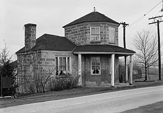
Three of the road's original toll houses are preserved:
- La Vale, Maryland
- Petersburg Tollhouse, in Addison, Pennsylvania
- Searights Tollhouse, near Uniontown, Pennsylvania
Additionally, several Old National Pike Milestones—some well-maintained, others deteriorating, and yet others represented by modern replacements—remain intact along the route.
Route description


In general, the road climbed westwards along the
By 1818, travelers could press on, still following Chief Nemacolin's trail across the ford, or taking a ferry to West Brownsville, moving through Washington County, Pennsylvania, and passing into Wheeling, Virginia (now West Virginia), 45 miles (72 km) away on the Ohio River. Subsequent efforts pushed the road across the states of Ohio and Indiana and into the Illinois Territory. The western terminus of the National Road at its greatest extent was at the Kaskaskia River in Vandalia, Illinois, near the intersection of modern US 51 and US 40.
Today, travelers driving east from Vandalia travel along modern US 40 through south-central Illinois. The National Road continued into Indiana along modern US 40, passing through the cities of Terre Haute and Indianapolis. Within Indianapolis, the National Road used the original alignment of US 40 along West and East Washington Street (modern US 40 is now routed along I-465). East of Indianapolis, the road went through the city of Richmond before entering Ohio, where the road continued along modern US 40 and passed through the northern suburbs of Dayton, Springfield, and Columbus.
West of Zanesville, Ohio, despite US 40's predominantly following the original route, many segments of the original road can still be found. Between Old Washington and Morristown, the original roadbed has been overlaid by I-70. The road then continued east across the Ohio River into Wheeling in West Virginia, the original western end of the National Road when it was first paved. After running 15 miles (24 km) in West Virginia, the National Road then entered Pennsylvania.
The road cut across southwestern Pennsylvania, heading southeast for about 90 miles (140 km) before entering Maryland. East of Keyser's Ridge, the road used modern Alt US 40 to the city of Cumberland (modern US 40 is now routed along I-68). Cumberland was the original eastern terminus of the road.
In the mid-19th century, a turnpike extension to Baltimore was approved—along what is now Maryland Route 144 from Cumberland to Hancock, US 40 from Hancock to Hagerstown, Alternate US 40 from Hagerstown to Frederick, and Maryland Route 144 from Frederick to Baltimore. The approval process was a hotly debated subject because of the removal of the original macadam construction that made this road famous.
The road's route between Baltimore and Cumberland continues to use the name National Pike or Baltimore National Pike and as Main Street in Ohio today, with various portions now signed as US 40,
Millionaires' Row
Nicknamed the "Main Street of America",
Historic designations

In 1976, the
There are several structures associated with the National Road that are listed on the National Register of Historic Places. Some are listed below.
Maryland
- Sixty-nine milestones in Maryland on Maryland Route 144 and Maryland Route 165, U.S. Route 40, U.S. Route 40 Alternate, and U.S. Route 40 Scenic
- Inns on the National Road in Cumberland, Maryland, and Grantsville, Maryland
- Casselman River Bridge near Grantsville, Maryland
Pennsylvania
The Pennsylvania Historical and Museum Commission has installed five historical markers noting the historic importance of the road: one in Somerset County on August 10, 1947, one in Washington County on April 1, 1949, and three in Fayette County on October 12, 1948, October 12, 1948, and May 19, 1996.[14]
- Petersburg Tollhouse in Addison, Pennsylvania
- Mount Washington Tavern adjacent to the Fort Necessity National Battlefield in Wharton Township, Pennsylvania
- Searights Tollhouse, National Road, in Uniontown, Pennsylvania
- National Historic Civil Engineering Landmark.
- Claysville S Bridge in Washington County, Pennsylvania, near Claysville, Pennsylvania
West Virginia
- Mile markers 8, 9, 10, 11, 13, and 14 in West Virginia
- National Road Corridor Historic District in Wheeling, West Virginia
- Wheeling Suspension Bridge in Wheeling, West Virginia
Ohio
- Peacock Road in Cambridge, Ohio
- The Red Brick Tavern in Lafayette, Madison County, Ohio, built in 1837
Indiana
Illinois
- Old Stone Arch, National Road, near Marshall, Illinois[16]
Gallery
- National Road
-
 Petersburg Tollhouse, National Road, Addison, Pennsylvania
 -
 Red Brick Tavern, National Road, Lafayette, Ohio
 -
 Mile markers, West Virginia
 -
 Abandoned part at Clark Center, Illinois


See also
 U.S. Roads portal
 National Register of Historic Places portal
- National Old Trails Road (Ocean-to-Ocean Highway)
References
- ^ Hulbert, Archer B. (1920). Johnson, Allen; Jefferys, Charles W.; Lomer, Gerhard R. (eds.). The Paths of Inland Commerce: a chronicle of trail, road, and waterway. The Chronicle of America Series. New Haven, Connecticut: Yale University Press.
- ^ "John Loudon MacAdam". Significant Scots. ElectricScotland.com. Retrieved June 19, 2010.
- ^ "Bird's Eye View of Cumberland, Maryland 1906". World Digital Library. 1906. Retrieved July 22, 2013.
- ^ Longfellow, Rickie (June 27, 2017). "The National Road: Back in Time". Highway History. Federal Highway Administration. Retrieved February 25, 2019.
- ^ "U.S. Transportation Secretary Mineta Names 36 New National Scenic Byways, All-American Roads (6/13/02)" (Press release). Federal Highway Administration. Retrieved August 23, 2013.
- ^ "Original Contract Information For the Construction of the Cumberland Road / National Road – 1811 to 1812". The Cumberland Road Project. February 16, 2010. Archived from the original on October 13, 2014. Retrieved February 12, 2016.
- ^ Selbert, Pamela (May 30, 2004). "A drive into the past on the Illinois National Road". Chicago Tribune. Retrieved May 7, 2020.
- ^ Lowry, Patricia (January 7, 1999). "A bridge to the 19th century: Falling water-level of Youghiogheny unearths ghost town, historical crossing". The Pittsburgh Post-Gazette. Retrieved July 17, 2017.
- ^ "About Wayne County". Visit Richmond Indiana. Richmond / Wayne County IN Convention and Visitors Bureau. Retrieved August 17, 2021.
- ^ Stephens, Steve. "Inn for the Night: Just past Ohio border, restored mansion awaits in Richmond, Ind". The Columbus Dispatch. Retrieved August 17, 2021.
- Advance Local Media. Retrieved August 17, 2021.
- ^ Institute of Traffic Engineers (1976). Traffic Engineering. Institute of Transportation Engineers. p. 9.
- ^ Parks, Greg (June 25, 1976). "Ceremony Designating National Road Civil Engineering Landmark Held Here". New Concord Leader.
- ^ "National Road – PHMC Historical Markers". Historical Marker Database. Pennsylvania Historical & Museum Commission. Archived from the original on December 7, 2013. Retrieved December 9, 2013.
- ISBN 0-471-14385-5.
- ^ "National Register Information System". National Register of Historic Places. National Park Service. March 15, 2006.
Further reading
- Raitz, Karl B.; Thompson, George F.; Pauer, Gyula (1996). The National Road. Johns Hopkins University Press. OCLC 33667988. restricted access
- Sky, Theodore (2012). The National Road and the Difficult Path to Sustainable National Investment. University of Delaware Press.
External links
- American Society of Civil Engineers landmark information
- National Road Association of Illinois – National Road in Illinois
- Indiana National Road Association – National Road in Indiana
- Ohio National Road Association – National Road in Ohio
- National Road in West Virginia Archived November 5, 2012, at the Wayback Machine – by the West Virginia Department of Commerce
- National Road Heritage Corridor – National Road in Pennsylvania
- The National Old Trails Road Part 1: The Quest for a National Road
- Maryland's Bank Road (Baltimore to Cumberland)
- PRR Chronology
- The Historic National Road, from the America's Byways website of the Federal Highway Administration
- The National Old Trails Road Photo Gallery
- Ohio National Road driving tour
- National Register of Historic Places nomination form – Pennsylvania
- National Register of Historic Places nomination form – West Virginia
- 125 M to B: The National Pike and National Road
| Authority control databases: National |
|---|