
Okemah, Oklahoma
Okemah, Oklahoma | ||
|---|---|---|
City | ||
FIPS code 40-54200[3] | | |
| GNIS feature ID | 2411310[2] | |
| Website | okemahok.org | |
Okemah (

History
Historically occupied by the
Okemah was named after a Kickapoo Indian chief. In March 1902, Chief Okemah built a bark house in his tribe's traditional fashion. He had come to await the opening of the townsite, which took his name on April 22, 1902. In the Kickapoo language, okemah means "things up high," such as a highly placed person or town, or high ground.[citation needed]
In preparation for Oklahoma's statehood, the Dawes Commission was authorized in 1896 to work with the Five Civilized Tribes to enroll their members for allotments of tribal land to individual households. Registration of tribal members lasted from 1898 to 1906. After allotment, the government was going to declare the remaining tribal lands "surplus" and sell them to European-American settlers.
Okemah was platted by a group of Shawnee residents in March 1902 on land belonging to Mahala and Nocus Fixico, full-blood Creek. The Fixicos had no legal right at the time to sell their holding, as enrollment of tribal members on the Dawes Roll continued until 1906, and no land-sales were to take place by Indians until it was completed. That did not appear to affect the promoters or the development of the town.
On April 22, 1902, the formal opening launched the town. A post office opened on May 16,
In the town's first week, the following stores were established: four general merchandise, two hardware, one 5 & 10 cent store, three drugstores, four groceries, three wagon-yards, four lumberyards, three cafes, one bakery, two millineries, four livery-barns, three blacksmiths, two dairies, two cotton-gins, and two weekly newspapers. Eight doctors settled there, four lawyers, two walnut log buyers, and one Chinese laundryman. Two hotels were quickly put up, including the three-story Broadway hotel, which set the city apart as an important town in early Oklahoma.
Firsts


The townsite was selected by two railroad surveyors, Perry Rodkey and H.R. Dexter. Dexter is credited with choosing the town name. They picked the site believing that two railroads, the
The town's first state-chartered bank began business the day of the opening, April 22, 1902, in a tent on the northwest corner of the present Fifth and Broadway (now City Hall). C. J. Benson was president. W. H. Dill was vice president and served as cashier. It became the First National Bank[7] in 1903, but was liquidated in 1939, having failed due to the Dust Bowl and the Great Depression.
J. E. Galloway was the first mayor; Perry Rodkey, first postman; E. D. Dexter, first hotel operator; Dill ran the first telephone company; John D. Richards had the first hardware store; McGee Brothers put in the first cotton gin; and E. E. Shook established the first lumberyard. The first church in the city was the North
Lynching
Although a police force was organized in the town soon after its founding (a Mr. Franklin wore the first city policeman's badge),
In 1911, a black woman, 35-year-old Laura Nelson, and her teenage son, L. D., were
Geography and climate
| Okemah, Oklahoma | ||||||||||||||||||||||||||||||||||||||||||||||||||||||||||||
|---|---|---|---|---|---|---|---|---|---|---|---|---|---|---|---|---|---|---|---|---|---|---|---|---|---|---|---|---|---|---|---|---|---|---|---|---|---|---|---|---|---|---|---|---|---|---|---|---|---|---|---|---|---|---|---|---|---|---|---|---|
| Climate chart (explanation) | ||||||||||||||||||||||||||||||||||||||||||||||||||||||||||||
| ||||||||||||||||||||||||||||||||||||||||||||||||||||||||||||
| ||||||||||||||||||||||||||||||||||||||||||||||||||||||||||||
According to the United States Census Bureau, the city has a total area of 2.7 square miles (7.0 km2), of which 2.6 square miles (6.7 km2) is land and 0.1 square miles (0.26 km2) (2.63%) is water.
| Climate data for Okemah, Oklahoma (1991–2020 averages) | |||||||||||||
|---|---|---|---|---|---|---|---|---|---|---|---|---|---|
| Month | Jan | Feb | Mar | Apr | May | Jun | Jul | Aug | Sep | Oct | Nov | Dec | Year |
| Record high °F (°C) | 82 (28) |
93 (34) |
94 (34) |
99 (37) |
97 (36) |
108 (42) |
114 (46) |
115 (46) |
111 (44) |
99 (37) |
88 (31) |
83 (28) |
115 (46) |
| Mean daily maximum °F (°C) | 49.7 (9.8) |
54.8 (12.7) |
64.6 (18.1) |
72.9 (22.7) |
79.8 (26.6) |
88.1 (31.2) |
93.0 (33.9) |
92.5 (33.6) |
84.8 (29.3) |
74.1 (23.4) |
61.4 (16.3) |
51.5 (10.8) |
72.3 (22.4) |
| Mean daily minimum °F (°C) | 30.3 (−0.9) |
34.4 (1.3) |
42.5 (5.8) |
50.5 (10.3) |
60.1 (15.6) |
67.5 (19.7) |
71.3 (21.8) |
70.0 (21.1) |
63.3 (17.4) |
52.1 (11.2) |
41.4 (5.2) |
33.1 (0.6) |
51.4 (10.8) |
| Record low °F (°C) | −10 (−23) |
−11 (−24) |
−2 (−19) |
21 (−6) |
35 (2) |
45 (7) |
53 (12) |
49 (9) |
34 (1) |
17 (−8) |
11 (−12) |
−9 (−23) |
−11 (−24) |
| Average precipitation inches (mm) | 1.76 (45) |
2.14 (54) |
3.20 (81) |
4.41 (112) |
5.72 (145) |
5.22 (133) |
3.28 (83) |
3.33 (85) |
4.85 (123) |
3.92 (100) |
3.08 (78) |
2.62 (67) |
43.53 (1,106) |
| Average snowfall inches (cm) | 2.9 (7.4) |
0.4 (1.0) |
0.6 (1.5) |
0 (0) |
0 (0) |
0 (0) |
0 (0) |
0 (0) |
0 (0) |
0 (0) |
0.3 (0.76) |
0.8 (2.0) |
5.0 (13) |
| Source: NOAA[9]
| |||||||||||||
Demographics
| Census | Pop. | Note | %± |
|---|---|---|---|
| 1910 | 1,389 | — | |
| 1920 | 2,162 | 55.7% | |
| 1930 | 4,002 | 85.1% | |
| 1940 | 3,811 | −4.8% | |
| 1950 | 3,454 | −9.4% | |
| 1960 | 2,836 | −17.9% | |
| 1970 | 2,913 | 2.7% | |
| 1980 | 3,381 | 16.1% | |
| 1990 | 3,085 | −8.8% | |
| 2000 | 3,038 | −1.5% | |
| 2010 | 3,223 | 6.1% | |
| 2020 | 3,074 | −4.6% | |
| U.S. Decennial Census[10] | |||
As of the census
There were 1,242 households, out of which 29.5% had children under the age of 18 living with them, 41.8% were married couples living together, 15.0% had a female householder with no husband present, and 38.5% were non-families. 35.7% of all households were made up of individuals, and 18.4% had someone living alone who was 65 years of age or older. The average household size was 2.35 and the average family size was 3.04.
In the city, the population was spread out, with 27.4% under the age of 18, 8.9% from 18 to 24, 23.3% from 25 to 44, 19.9% from 45 to 64, and 20.5% who were 65 years of age or older. The median age was 37 years. For every 100 females, there were 82.2 males. For every 100 females age 18 and over, there were 76.8 males.
The median income for a household in the city was $21,306, and the median income for a family was $26,659. Males had a median income of $21,905 versus $15,375 for females. The
Education
History
S. L. O'Bannon was the teacher in the first school, which opened in 1902 with funds gained by subscribers.[citation needed] Classes were held in a store building. The first school building was built in 1902. It was later replaced by the Wilson School on the same site. The first public school was opened with Dr. Z. Cheatwood as superintendent in 1904.[citation needed]
A store building housed one of the first public schools, and the other was held in a building where the American Legion building now stands. Noble School, completed in 1907, was named for Miss Mae Noble. Okemah High School gained accreditation in 1912. It met in the old Noble School building until the building of 1918 was erected. In the high school complex, the band shop building was erected 1941 and a vocational building in 1948.[citation needed]
Parks, recreation and events
Okemah Lake, north of town, is a city lake that features swimming, boating, hunting, fishing, and camping.[11]
Okemah’s Municipal Park at Ash St. and S. 2nd St., now with picnic tables and playground equipment, was originally constructed by the WPA in 1935.[12]
Pioneer Days in Okemah are the last weekend in April annually.[13]
The Woody Guthrie Folk Festival, also known as WoodyFest, occurs annually in July.[14]
Transportation
Okemah is at the intersection of Interstate 40 and State Highway 27.[15]
Okemah Airport (FAA Identifier: F81), two miles south of town, features a 3,400-foot runway.[16]
Notable people
- Larry Coker - Football coach
- Evan Felker - Lead singer for country music band Turnpike Troubadours
- americanasinger/songwriter
- Woody Guthrie - Folk singer
- Economic historian
- Leon C. Phillips - Governor of Oklahoma, 1939–43
- William Reid Pogue- astronaut
- Shawna Russell - country singer/songwriter
NRHP sites
The following sites in Okemah are listed on the National Register of Historic Places:
- Okemah Armory
- Okfuskee County Courthouse
References
- ^ "ArcGIS REST Services Directory". United States Census Bureau. Retrieved September 20, 2022.
- ^ a b U.S. Geological Survey Geographic Names Information System: Okemah, Oklahoma
- ^ a b "U.S. Census website". United States Census Bureau. Retrieved January 31, 2008.
- ^ Rick Aschmann (May 2, 2018). "North American English Dialects, Based on Pronunciation Patterns". Aschmann.net. Retrieved November 25, 2019.
- ^ "Find a County". National Association of Counties. Archived from the original on May 31, 2011. Retrieved June 7, 2011.
- ^ a b Price, Carolyn S. Burnett. Encyclopedia of Oklahoma History and Culture. "Okemah." Retrieved February 9, 2013.[1]
- ^ The Bankers Magazine - Volume 76 - Page 647 - Google Books Result 1908 - Banks and banking Okemah—First National Bank: R. W. Armstrong, Asst. Cashicr.
- ^ Davidson, James West (2007). "They say": Ida B. Wells and the Reconstruction of Race. New York: Oxford University Press. pp. 5–8.
- ^ "NOAA NCEI U.S. Climate Normals Quick Access". National Oceanic and Atmospheric Administration. Retrieved December 3, 2021.
- ^ "Census of Population and Housing". Census.gov. Retrieved June 4, 2015.
- ^ "Okemah Lake". City of Okemah. Retrieved July 3, 2020.
- ^ "Municipal Park-Okemah OK". The Living New Deal. Retrieved July 3, 2020.
- ^ "Pioneer Days". City of Okemah. Retrieved July 3, 2020.
- ^ "History of the Festival". Woody Guthrie Folk Festival. March 31, 2018. Retrieved July 3, 2020.
- ^ "Okemah, Oklahoma". Google Maps. Retrieved July 4, 2020.
- ^ "Airport". City of Okemah. Retrieved July 3, 2020.
External links
Municipalities and communities of Okfuskee County, Oklahoma, United States | ||
|---|---|---|
| City | 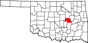 | |
| Towns | ||
| CDP | ||
| Other communities | ||
| Indian reservation | ||
| Footnotes | ‡This populated place also has portions in an adjacent county or counties | |
| ||
| International | |
|---|---|
| National | |
| Geographic | |