
Wilburton, Oklahoma
Wilburton, Oklahoma | ||
|---|---|---|
FIPS code 40-81000[2] | | |
| GNIS ID | 1099754[3] | |
| Website | cityofwilburton.com | |
Wilburton is a city in Latimer County, Oklahoma, United States. It is the county seat of Latimer County.[4] The city had a population of 2,285 as of the 2020 Census.[5] Robbers Cave State Park is 5 miles (8.0 km) north of Wilburton.[6]
History
,_ca._1898_-_NARA_-_516380.jpg)
The community now known as Wilburton was originally established as a group of settlers living around Riddle's Station, a stop for the
On 18 January 1926, ninety-one people were killed in a coal mine explosion in or near Wilburton.[9]
A tornado struck Wilburton on May 5, 1960, and injured more than one hundred people and killed thirteen.[6]
Initially, the local economy was based on cattle production and shipping. Then, during the 1890s and early 20th century, coal mining became the largest industry. In 1909, the state established the Oklahoma School of Mines and Metallurgy in Wilburton. The school name was later changed to Eastern Oklahoma A&M College and it is now known as Eastern Oklahoma State College.[6]
Geography
Wilburton is located at 34°55′6″N 95°18′38″W / 34.91833°N 95.31056°W (34.918379, -95.310645).[10] According to the United States Census Bureau, the city has a total area of 3.0 square miles (7.8 km2), of which 3.0 square miles (7.8 km2) is land and 0.33% is water.
Government
Wilburton has a statutory
Demographics
| Census | Pop. | Note | %± |
|---|---|---|---|
| 1910 | 2,277 | — | |
| 1920 | 2,226 | −2.2% | |
| 1930 | 1,524 | −31.5% | |
| 1940 | 1,925 | 26.3% | |
| 1950 | 1,939 | 0.7% | |
| 1960 | 1,772 | −8.6% | |
| 1970 | 2,504 | 41.3% | |
| 1980 | 2,996 | 19.6% | |
| 1990 | 3,092 | 3.2% | |
| 2000 | 2,972 | −3.9% | |
| 2010 | 2,843 | −4.3% | |
| 2020 | 2,285 | −19.6% | |
| U.S. Decennial Census[11][5] | |||
As of the
There were 1,004 households, out of which 34.0% had children under the age of 18 living with them, 48.4% were married couples living together, 14.5% had a female householder with no husband present, and 32.8% were non-families. 30.3% of all households were made up of individuals, and 15.4% had someone living alone who was 65 years of age or older. The average household size was 2.49 and the average family size was 3.07.
In the city, the population was spread out, with 24.4% under the age of 18, 20.5% from 18 to 24, 23.4% from 25 to 44, 16.4% from 45 to 64, and 15.4% who were 65 years of age or older. The median age was 30 years. For every 100 females, there were 85.5 males. For every 100 females age 18 and over, there were 80.7 males.
The median income for a household in the city was $20,878, and the median income for a family was $25,543. Males had a median income of $22,917 versus $18,684 for females. The
Parks and recreation
City of Wilburton park facilities include the Gary Rosebure Recreational Park.[12]
Sycamore Springs Golf Course is a 9-hole, semi-private golf course opened in 1970.[13]
Robbers Cave State Park, which encompasses Lake Carlton, Lake Wayne Wallace, and Coon Creek Lake, is located approximately 5 miles (8 km) north-northwest of the town.[14]
Lloyd Church Lake to the south-southeast of town.[14]
Education
Primary and secondary education
The Wilburton Public School District oversees the Grace Russell Elementary School, the John G. Shero Middle School, and the Nancy W. Taylor High School.
Adult education
Transportation
Wilburton is served by
Wilburton is in the region served by the KI BOIS Area Transit System ("KATS"), a low-cost public bus/van service established in 1983 to help communities, primarily in southeast Oklahoma, by providing access to Senior Citizen centers, groceries, medical services, and jobs.[16][17]
Wilburton Municipal Airport (FAA ID: H05) is 4 miles west of town, and features a 3000’ x 60’ paved runway.[18]
Commercial air transportation is available out of Fort Smith Regional Airport, about 70 miles northeast.[19]
The town has freight rail service through the
References
- ^ "ArcGIS REST Services Directory". United States Census Bureau. Retrieved September 20, 2022.
- ^ a b "U.S. Census website". United States Census Bureau. Retrieved January 31, 2008.
- ^ "US Board on Geographic Names". United States Geological Survey. October 25, 2007. Retrieved January 31, 2008.
- ^ "Find a County". National Association of Counties. Retrieved June 7, 2011.
- ^ a b "Wilburton (city), Oklahoma". United States Census Bureau. Retrieved June 13, 2023.
- ^ a b c d e f Johnston, Betty Wooldridge. Oklahoma Encyclopedia of History and Culture. "Wilburton." Retrieved March 5, 2015.[1]
- ^ a b Shirk, George H. Oklahoma Place Names, Norman, Oklahoma: University of Oklahoma Press, 1965, p.222.
- ^ Morris, John W. Historical Atlas of Oklahoma (Norman: University of Oklahoma, 1986), plate 38.
- ^ ""Disasters"". Powell Valley News. January 7, 1927. Retrieved August 21, 2023.
- ^ "US Gazetteer files: 2010, 2000, and 1990". United States Census Bureau. February 12, 2011. Retrieved April 23, 2011.
- ^ "Census of Population and Housing". Census.gov. Retrieved June 4, 2015.
- ^ "Parks & Recreation". City of Wilburton. Retrieved August 3, 2020.
- ^ "Sycamore Springs Golf Course". GolfAdvisor. Retrieved August 3, 2020.
- ^ a b "Wilburton, Oklahoma". Google Maps. Retrieved August 3, 2020.
- ^ "Wilburton, Oklahoma". Google Maps. Retrieved August 29, 2021.
- ^ "Oklahoma Department of Transportation Website-- KI BOIS Area Transit System". Retrieved June 15, 2011.
- ^ "Wilburton". KI BOIS Area Transit System. Retrieved August 29, 2021.
- ^ "Wilburton Municipal Airport". AirNav.com. Retrieved August 29, 2021.
- ^ "Major airports near Wilburton, Oklahoma". travelmath.com. Retrieved August 29, 2021.
- ^ "Freight Services". Arkansas-Oklahoma Railroad Co. Retrieved August 29, 2021.
- ^ "AOK: Arkansas-Oklahoma Railroad" (PDF). Kansas City Southern Lines. Retrieved August 29, 2021.
- ^ "Arkansas-Oklahoma Railroad". Union Pacific. Retrieved August 29, 2021.
External links
- Official website
- Wilburton Chamber of Commerce[usurped]
- Wilburton Public School District
- Latimer County Public Library
- Oklahoma Digital Maps: Digital Collections of Oklahoma and Indian Territory
Municipalities and communities of Latimer County, Oklahoma, United States | ||
|---|---|---|
| City | 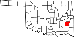 | |
| Towns | ||
| CDPs | ||
| Indian reservation | ||
| Footnotes | ‡This populated place also has portions in another county or counties | |
| ||
| International | |
|---|---|
| National | |
| Other | |