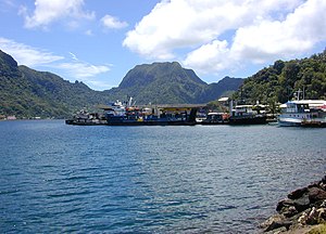
Pago Pago Harbor


Pago Pago Harbor on
South Pacific Ocean or in Oceania as a whole.[4][5] Pago Pago Bay is over 400 feet (120 m) deep and two miles (3.2 km) long. As part of the Pago Volcano caldera, the harbor is 50% landlocked.[6]
Villages along the harbor include several communities in the Greater Pago Pago Area, including
Atu'u. The legislature and High Court are located in Fagatogo, while the executive offices are located in Utulei.[7]
Pago Pago Harbor is surrounded and sheltered by mountains such as
Mount Matafao and Rainmaker Mountain (Mount Pioa).[8] The entrance to Pago Pago Bay is marked by two mountains: Peiva in the east and Matafao Peak in the west.[9] The harbor is all that remains from the volcanic crater that built Tutuila Island. At some point, one wall of the crater collapsed and the sea came rushing in creating a near complete shelter from the power of the sea at large.[10]
The village communities which lie within the Pago Pago Bay Area are jointly known as
Faga'alu.[9]
Tsunami
Fagatogo was struck by a
rock slides.[11]
A significant amount of
polluted and will require an extensive cleanup program with a significant amount of manpower ... The destruction is everywhere." An oil spill approximately 40 feet (12 m) wide occurred at the mouth of Pago Pago Harbor as a result of the tsunami. Barrels containing fuel were thrown into the harbor by the tsunami and washed up on shore.[12]
It was suggested that one must avoid eating any fish or invertebrate caught in Pago Pago Harbor because they are contaminated with heavy metals and other pollutants.[13]
References
- ^ Joanne Thomas. "American Samoa Cruises". USA Today.
- ^ "Archived copy" (PDF). Archived from the original (PDF) on 2017-01-30. Retrieved 2017-10-24.
{{cite web}}: CS1 maint: archived copy as title (link) - ^ "Archived copy". Archived from the original on 2017-10-19. Retrieved 2017-10-19.
{{cite web}}: CS1 maint: archived copy as title (link) - ISBN 9780791010532.
- ISBN 9780613032421.
- ISBN 9780896103399.
- ^ Tutuila Island Map, National Park Service.
- ^ "Port of Pago Pago, American Samoa". Department of Port Administration. Retrieved 17 August 2022.
- ^ ISBN 9780824822194.
- ISBN 9780864422255.
- ^ FILI SAGAPOLUTELE. "Residents flee tsunami after strong quake in Samoa". Associated Press. Archived from the original on October 3, 2009.
- ^ "Coral Reef Advisory tsunami report focuses on extensive marine and coastal debris". Samoa News. 2009-10-07. Archived from the original on 2011-06-07. Retrieved 2009-10-07.
- ^ "Natural History Guide To American Samoa". National Park Service. Archived from the original on 28 May 2010.
