Palcaraju
| Palcaraju | |
|---|---|
 Lake Palcacocha with lower slopes of Palcaraju (left) and Pucaranra (right). | |
| Highest point | |
| Elevation | 6,274 m (20,584 ft) |
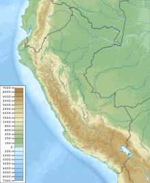
| Coordinates | 09°22′06″S 77°22′15″W / 9.36833°S 77.37083°W |
| Geography | |
| Location | Ancash, Peru |
| Parent range | Andes, Cordillera Blanca |
| Climbing | |
| First ascent | 1939 |
Palcaraju
Palcaraju has three peaks: Palcaraju (6,274 metres (20,584 ft)), Palcaraju Oeste 6,110 metres (20,046 ft) and Palcaraju Sur 6,274 metres (20,584 ft).[1]
In July 2012, two American climbers, Ben Horne and Gil Weiss, died on the way back down, after scaling the south face of Palcaraju W.[7]
References
- ^ a b c d "Nevado Palcaraju". Inventario Turístico del Perú (in Spanish). MINCETUR. Archived from the original on 2016-03-04. Retrieved 2016-06-04.
- ISBN 9780953608768.
- ^ ISBN 3928777572.
- ^ Teofilo Laime Ajacopa, Diccionario Bilingüe Iskay simipi yuyayk'ancha, La Paz, 2007 (Quechua-Spanish dictionary): pallqa, P'ALLQA - adj. Bifurcado, ahorquillado. pallqa. - s. Bifurcación. Punto donde se separan dos o más vías o caminos.
- ^ Diccionario Quechua - Español - Quechua, Academía Mayor de la Lengua Quechua, Gobierno Regional Cusco, Cusco 2005: p'alqa - s. Bifurcación, desvío, final en V. de una rama de árbol. EJEM: p'alqa k'aspi, rama de árbol que termina en V. SINÓN: tanka. Pe.Aya: pallja. Pe.Jun: palja. Ec: pallka.
- ^ "babylon.com". Archived from the original on 2014-12-29. Retrieved 2013-04-19.
- ^ Brocchetto, Marilia (July 28, 2012). "2 American climbers found dead in Peruvian mountains". Retrieved 2012-07-29.

