People's Park (São Paulo)
| People's Park | |
|---|---|
 People's Park | |
| Nearest city | São Paulo |
| Coordinates | 23°35′16″S 46°41′19″W / 23.5878°S 46.6886°W |
| Area | 133,547 square metres (1,437,490 sq ft) |
| Created | 2008 |
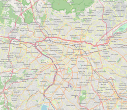
The Mário Pimenta Camargo Municipal Park, or People's Park, was inaugurated on 28 September 2008, in the district of Itaim Bibi, in the district of Chácara Itaim, in São Paulo, Brazil. The People's Park is referred to as the "Parque do Povo" in Portuguese.
The park

It is an area of 133,547 square metres (1,437,490 sq ft) that counts on a sports complex of three multisports courts with special marking for paralympic sports, green grass soccer field, cycling track skateboarding, walking, running track, a real-life chess game in which people can move the huge pieces in a checkered board on the ground, track and exercise equipment for the public to enjoy. In the grand open area of the lawn that is located in the central part, it is possible to sunbathe or picnic in the middle of the trees.[1][2]
The Sensitive Garden, which has aromatic herbs, gives the public the opportunity to smell, touch or even taste some of the delicacies that grow in the garden, such as mustard, coriander, green odor, chives, aloe and basil. The place has full accessibility for people with reduced mobility, made with materials recovered from demolitions carried out by the city for the construction of its sidewalks, such as the recyclable waste of buildings found in the central region of the city of São Paulo.
See also
References
- ^ "Parque do Povo" (in Portuguese). www.cidadedesaopaulo.com. Retrieved 2017-04-25.
- ^ "Povo - Mário Pimenta Camargo" (in Portuguese). Government of São Paulo. Retrieved 2016-11-07.


