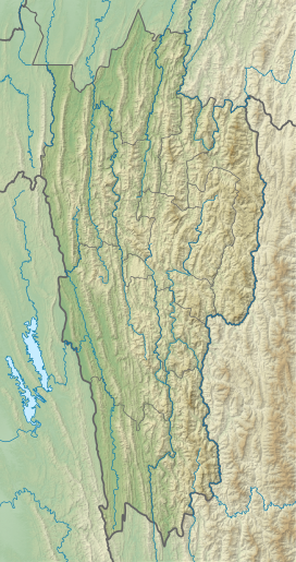
Phawngpui
| Phawngpui | |
|---|---|
| Phunpi Klang | |
List of Indian states and territories by highest point | |
| Coordinates | 22°37′53.4″N 93°02′19.68″E / 22.631500°N 93.0388000°E[1] |
| Geography | |
near the Myanmar border in Lawngtlai District | |
Mizoram, India | |
| Topo map | "NF 46-7, Gangaw, Burma"[2] |
Phawngpui (Pron: /ˌpʰɔ:ŋˈpʊɪ/), also known as Blue Mountain, is the highest mountain peak in the Mizo Hills (Lushai Hills) and in the state of Mizoram, India,[3] with an elevation of 2157 m.[4] It is in Lawngtlai district, in the southeastern region of Mizoram near the Myanmar border.
Geography
Phawngpui is the highest peak of the Lushai Hills. There is a semicircular series of cliffs on the western side called Thlazuang Khàm, which have a sharp and deep fall; mountain goats live there. These cliffs are believed to be haunted by spirits.[5] On the peak, there is a level ground of about 2 km2 in area.
Etymology and origin
A highly revered peak, considered to be the abode of local deities, Phawngpui was a major centre of
Conservation
Since 1992 the mountain has been included in the
Flora and fauna
The area is encircled by matted
See also
Gallery
-
Park at sunrise
-
Farpak grassland
References
- ^ Phunpi Klang (Approved - N) at GEOnet Names Server, United States National Geospatial-Intelligence Agency
- ^ "NF 46-7, Gangaw, Burma" topographic map, Series U542, U.S. Army Map Service, April 1958, listed as Blue Mountain
- ^ "Phawngpui". MizoTourism. Archived from the original on 3 March 2013.
- ISBN 8172112645.
- ISBN 9788178353753.
- ^ Property Direction (18 April 2013). "Phawngpui Blue Mountain National Park, Mizoram, in Bairro Santo Angelo at Nimruz". Property and Real Estate in Bairro Santo Angelo. Retrieved 26 June 2013.
- ^ World Wildlife Adventures. "Phawngpui Blue Mountain National Park, Mizoram". world-wildlife-adventures.com. Archived from the original on 27 March 2013. Retrieved 26 June 2013.
- ^ "Thla 6 chhungin Rs. 10,190/- hmu" [Rs. 10,190/- collected in 6 months]. Zothlifim (in Mizo). 15 May 2013. Archived from the original on 13 July 2015. Retrieved 26 June 2013.
- ^ Shivaram, Shivaram. "Phawngpui (Blue Mountain) National Park". The Jungle Book. Retrieved 21 August 2012.
- ^ CHOUDHURY, ANWARUDDIN (2006). "Notable bird records from Mizoram in north-east India". Oriental Bird Club. Retrieved 21 August 2012.
- ^ Ghose D (2002). "First sighting of the clouded leopard Neofelis nebulosa from the Blue Mountain National Park, Mizoram, India" (PDF). Current Science. 83 (1): 20–21.
- ^ "Naubân rutute an man". Vanglaini. Retrieved 21 August 2012.
External links
- Mizoram Tourism [1]


